Edison, Fresno
Updated · 28,362 residents
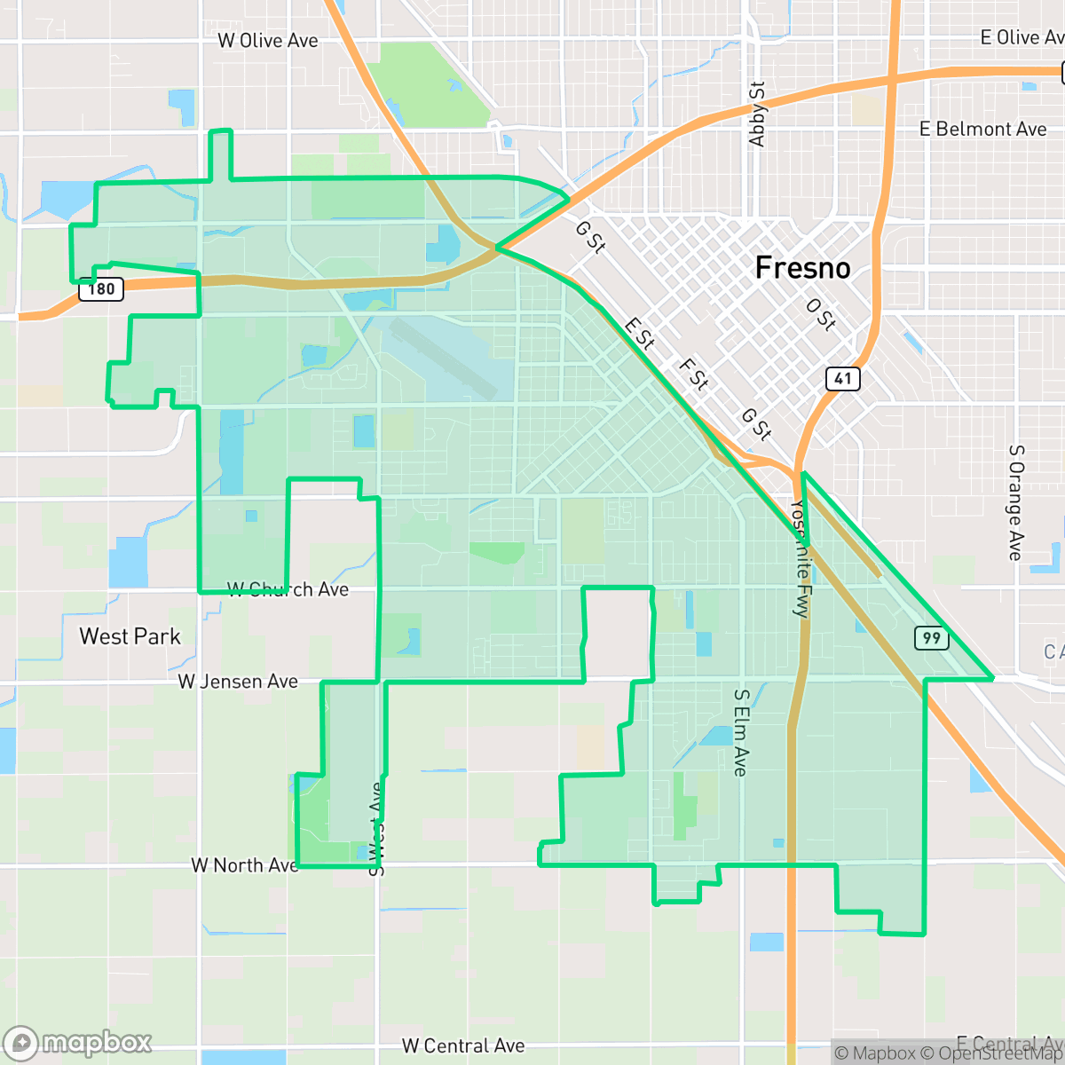
Edison is a historic Southwest Fresno community defined by its tight-knit residential grid and deep cultural roots centered around Edison High School. While the area offers a traditional suburban layout, residents experience a high-density environment with limited private outdoor space and significant proximity to industrial logistics hubs.
Key Highlights
About Edison
The Edison neighborhood in Southwest Fresno, California, is a historically diverse community anchored by Edison High School, founded in 1906. In the early 20th century, the area served as a primary port of entry for German, Russian, Italian, and Japanese immigrants. During the Great Migration, it evolved into a prominent, tight-knit Black community. However, systemic 1930s federal redlining restricted minority residents to the area and starved it of investment. Mid-century urban planning further isolated the neighborhood, as the construction of Highways 99 and 41 demolished entire residential blocks and local green spaces like Cosmo Park. Despite decades of civic disinvestment and environmental challenges, the neighborhood retains a rich cultural identity and a strong legacy of community advocacy, currently championed by organizations like the Southwest Fresno Development Corporation.
Edison functions as a dense suburban enclave characterized by a consistent street grid and modest tract housing. It maintains a strong institutional presence through local landmarks like Edison High School and Edison Computech, which provide educational stability amidst a broader landscape of industrial warehouses and freight corridors. The area is largely defined by its proximity to major transportation infrastructure, including Highway 99, which shapes the daily experience of residents through consistent road noise and a high-density footprint.
Living here involves trade-offs between affordability and environmental factors. The area is notably car-dependent, with narrow sidewalks and limited green space beyond school athletic fields. While the community benefits from a stable core of long-term residents and active advocacy, prospective inhabitants should note the high industrial proximity, which results in significant truck traffic and air quality challenges. It is best suited for those prioritizing community history and institutional access over the amenities of more modern or low-density suburban developments.
Neighborhood Scores Across 15 Qualities
Residential spacing is relatively consistent with the city average, offering a mix of closely packed homes and areas with more separation. While some blocks feature narrow side yards, local parks and schools provide occasional buffers between properties.
Pedestrian access is characterized by a consistent grid and sidewalks on many residential streets; however, connectivity is lower than the Fresno average due to large blocks and disruptions from high-traffic arterials. According to iHuus data, some western sections lack sidewalks, and nearby highway interchanges can impact ease of movement.
Standard tract housing dominates the landscape, featuring uniform rooflines and small yards. According to iHuus data, the visual variety and greenery levels are lower than the Fresno city average.
Access to large public parks and athletic fields provides several options for pet exercise, though sidewalk verges are often narrow. This level of greenery and park availability is roughly in line with the Fresno city average, according to iHuus data.
A combination of agricultural orchards, industrial warehouses, and scattered residential pockets creates a landscape that is slightly more open than the Fresno average. Residents will find a transition between low-density urban grids and expansive unpaved lots according to iHuus data.
Primarily characterized by warehouses, freight corridors, and low-density residential pockets, this area offers a serene atmosphere with limited commercial activity. The neighborhood lacks the vibrant social hubs found elsewhere in Fresno, as most amenities and dining options require a car to reach.
Steady hum from nearby busy streets defines the local soundscape, though it remains slightly quieter than the Fresno city average according to iHuus data.
Air quality levels in Edison are slightly better than the Fresno average, though residents may still encounter days that are unhealthy for sensitive groups.
Significant logistics hubs and large-scale warehouses are interspersed with residential areas, resulting in lower industrial proximity compared to the Fresno average. Residents should be aware of nearby heavy truck traffic and the presence of a regional Superfund site that may affect local groundwater and soil.
Health insurance coverage among residents is lower than the Fresno city average, according to iHuus data.
Voting patterns and census indicators in Edison reflect a significantly more liberal leaning than the Fresno city average, according to iHuus data.
Residents live alongside a balanced mix of young adults, families, and older populations. This demographic spread is slightly lower than the Fresno city average according to iHuus data.
Flood vulnerability in Edison is significantly higher than the Fresno average. Residents should prepare for increased risks and potentially elevated insurance costs.
Address-Level Insights for Edison


iHuus Neighborhood Intelligence Insights
Get address-level neighborhood insights for Edison
- Street-level scores — see how individual blocks compare, not just neighborhood averages
- Micro-zone boundaries — identify quiet pockets, flood boundaries, and walkable clusters before you visit
- 15 dimensions in full — walkability, noise, air quality, school quality, insurance coverage, population age profile, urban/rural index, and more
- Boundary risk alerts — know if your address sits near a block boundary where scores drop, the kind of detail no listing will ever mention
- School insights — individual school ratings and insights, not just district-level data
- Compare before you commit — side-by-side data across neighborhoods, down to block precision
No credit card required
Compare with Any Neighborhood
| Dimension | Edison | Bullard |
|---|---|---|
| 🚶 Walkabilityavg 8.26 | ||
| 🔊 Acoustic Comfortavg 3.54 | ||
| 🤫 Privacy Indexavg 5.3 | ||
| 🎨 Visual Appealavg 6.38 | ||
| 🐕 Dog Friendlinessavg 5.63 | ||
| 🗺️ Urban-Rural Indexavg 6.71 | ||
| ✨ Neighborhood Vibeavg 4.35 | ||
| 🏥 Health Insurance Coverageavg 7.05 | ||
| 🌿 Air Qualityavg 4.98 | ||
| 🏭 Industrial Proximityavg 7.91 | ||
| 🌊 Flood Safetyavg 2.48 | ||
| 🗳️ Ideological Leanavg 7.13 | ||
| 👥 Population Age Profileavg 4.51 | ||
| 🔥 Fire Safetyavg 0.01 | ||
| 🏫 School Quality |
Edison Rankings
School Districts Serving Edison
School Insights for Edison
Below average outcomes; significant attendance and academic challenges.
School Insights
See what's really behind every school rating near Edison
- Individual school ratings — each school's own score with outcome context, not just a district average
- Enrollment & class size data — student-to-teacher ratio and how it compares to the state average
- Full demographics breakdown — ethnicity and gender composition for every school in the enrollment zone
- Every school in the district — all schools within the enrollment boundary ranked by rating, not just the closest one
- Grade levels & benchmarks — elementary through high school, with below/above state-average flags
No credit card required