El Rio, El Rio
Updated · 5,986 residents
El Rio is a dense suburban community in Ventura County characterized by its grid-based layout and proximity to expansive agricultural lands. Residents experience a quiet environment with modest housing, though the area faces challenges regarding limited public green space and local school performance.
Key Highlights
About El Rio
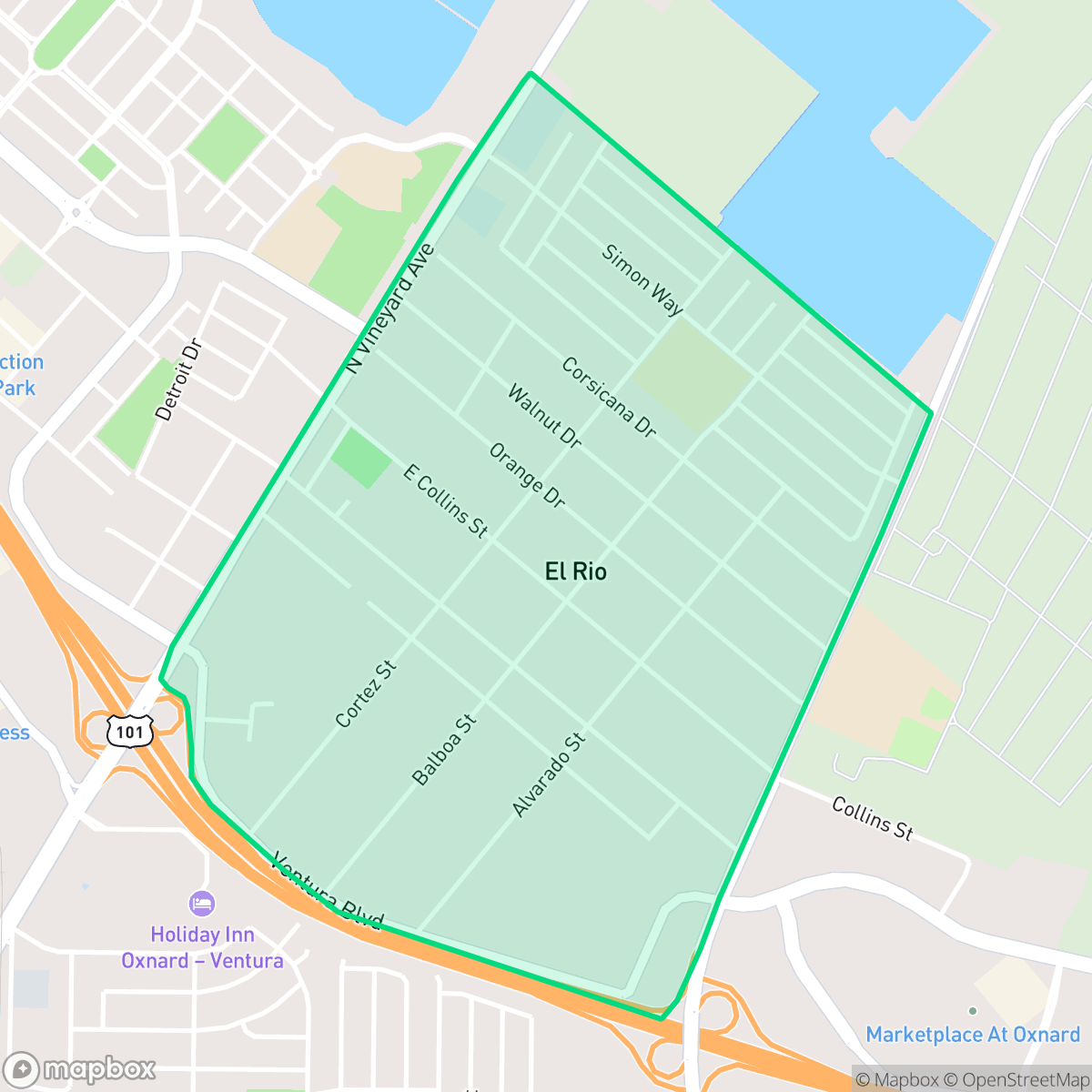
Founded in 1875 by Prussian Jewish merchant Simon Cohn, the unincorporated community of El Rio in Ventura County was originally named "New Jerusalem." Cohn established a general store at the site, which sat at a crossroads near the Santa Clara River. The town was renamed El Rio (Spanish for "the river") in 1905. Early landmarks include the historic Santa Clara Catholic Church, established in 1885 as the first Catholic church built in Ventura County since the founding of Mission San Buenaventura nearly a century earlier. Today, Vineyard Avenue (State Route 232) serves as the central business district for this largely residential neighborhood, which experienced a significant post-war housing boom in the 1950s. Many of its older residential streets bear the names of Spanish explorers, reflecting the area's complex colonial and agricultural heritage.
The neighborhood maintains a distinct suburban character defined by its dense residential grid and immediate transition into surrounding agricultural fields. It offers a straightforward, quiet atmosphere where the housing stock consists primarily of modest tract homes and mobile home parks. While the area provides high air quality and a consistent layout, the limited presence of local businesses and public parks contributes to a subdued pace of life.
Prospective residents should consider the trade-offs associated with local infrastructure, including the proximity to industrial warehouses and truck parking zones in the southwest and east. The educational landscape is marked by significant challenges, as local elementary and high school districts navigate achievement gaps and aging facilities. With limited private yard space and restricted access to dog-friendly areas, the neighborhood is best suited for those prioritizing a quiet, functional location near the Ventura County agricultural belt over high-density amenities or walkability.
Neighborhood Scores Across 15 Qualities
Residential spacing is consistent with the city average, featuring a mix of clustered housing and some distance between neighbors. Certain pockets, particularly near mobile home parks, contain more closely packed structures with minimal setbacks.
Pedestrian infrastructure is well-developed with many residential streets featuring continuous sidewalks and safe crossings. This network is slightly more comprehensive than the city average, though some industrial areas may lack dedicated verges.
Standard tract housing and apartment complexes define the landscape, featuring uniform rooflines and modest yard spaces. This visual character is typical for the area and aligns with the city average.
Public park access and wide green verges are available in certain areas, though overall amenities for pet owners are roughly in line with the city average according to iHuus data.
A mix of suburban residential grids and large agricultural fields defines the landscape, which is slightly less developed than the city average. Residents will find a blend of single-family homes and dense suburban pockets situated near open land and irrigation ponds.
A blend of light industrial zones and suburban streets provides a moderate level of activity that is slightly higher than the city average. Local dining options and green spaces offer pockets of liveliness, though some areas remain quiet and car-dependent.
Frequent noise from nearby railroad tracks and major freeways characterizes the area. According to iHuus data, acoustic comfort levels are slightly below the city average.
Air quality remains consistently high with minimal health concerns. This level of air purity is consistent with the city average, according to iHuus data.
Industrial presence is minimal across most of the area, though some large warehouses and logistics hubs with heavy truck traffic are located near the freeway and in certain corners of the neighborhood. According to iHuus data, the level of industrial proximity is roughly comparable to the city average.
Health insurance coverage in El Rio is moderate and slightly lower than the city average, according to iHuus data.
Voting patterns and census indicators reflect a predominantly liberal political leaning that is even more pronounced than the city average, according to iHuus data.
Residents live in a community with a diverse age distribution, matching the broader city average. This demographic spread includes a comparable balance of young adults, families, and older residents according to iHuus data.
Flood risk in this area remains uncertain because FEMA has not yet finalized a detailed study for this specific location. This level of risk is consistent with the average found throughout the city.
Address-Level Insights for El Rio


iHuus Neighborhood Intelligence Insights
Get address-level neighborhood insights for El Rio
- Street-level scores — see how individual blocks compare, not just neighborhood averages
- Micro-zone boundaries — identify quiet pockets, flood boundaries, and walkable clusters before you visit
- 15 dimensions in full — walkability, noise, air quality, school quality, insurance coverage, population age profile, urban/rural index, and more
- Boundary risk alerts — know if your address sits near a block boundary where scores drop, the kind of detail no listing will ever mention
- School insights — individual school ratings and insights, not just district-level data
- Compare before you commit — side-by-side data across neighborhoods, down to block precision
No credit card required
Compare with Any Neighborhood
| Dimension | El Rio | Strickland |
|---|---|---|
| 🚶 Walkabilityavg 7.7 | ||
| 🔊 Acoustic Comfortavg 2.52 | ||
| 🤫 Privacy Indexavg 4.43 | ||
| 🎨 Visual Appealavg 6 | ||
| 🐕 Dog Friendlinessavg 5.29 | ||
| 🗺️ Urban-Rural Indexavg 6.71 | ||
| ✨ Neighborhood Vibeavg 5.26 | ||
| 🏥 Health Insurance Coverageavg 4.15 | ||
| 🌿 Air Qualityavg 10 | ||
| 🏭 Industrial Proximityavg 7.12 | ||
| 🌊 Flood Safetyavg 5.89 | ||
| 🗳️ Ideological Leanavg 9.23 | ||
| 👥 Population Age Profileavg 4.47 | ||
| 🔥 Fire Safety | ||
| 🏫 School Quality |
El Rio Rankings
School Districts Serving El Rio
School Insights for El Rio
Below average outcomes; significant attendance and academic challenges.
School Insights
See what's really behind every school rating near El Rio
- Individual school ratings — each school's own score with outcome context, not just a district average
- Enrollment & class size data — student-to-teacher ratio and how it compares to the state average
- Full demographics breakdown — ethnicity and gender composition for every school in the enrollment zone
- Every school in the district — all schools within the enrollment boundary ranked by rating, not just the closest one
- Grade levels & benchmarks — elementary through high school, with below/above state-average flags
No credit card required