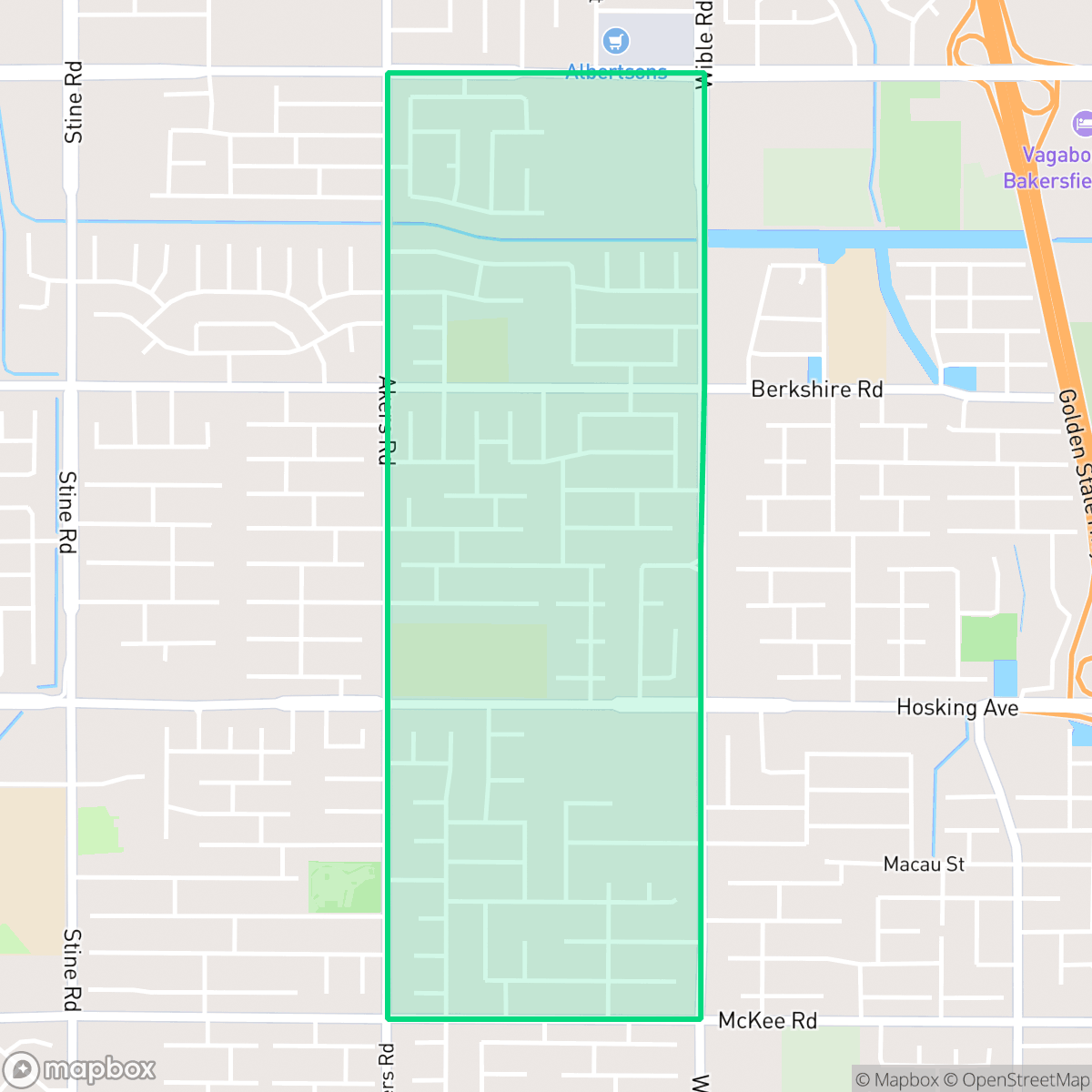
Stonegate, Bakersfield
Updated June 22, 2026 · 5,342 residents
Stonegate is a quiet, suburban neighborhood in Bakersfield characterized by its highly walkable street layout and well-manicured, affluent residential properties. While it offers excellent air quality and a complete absence of industrial hazards, the area remains a car-dependent environment with limited local commercial amenities.
Key Highlights
About Stonegate
Located in Bakersfield, this neighborhood features a dense, single-family tract housing layout defined by its visual appeal and consistent, pedestrian-friendly infrastructure. Residents benefit from high-quality air and a lack of industrial proximity, creating a clean and quiet living environment. The area is marked by large homes with private backyard pools and well-maintained landscaping, contributing to a cohesive suburban aesthetic that stands out within the city.
According to iHuus data, the area maintains a high level of walkability due to its extensive sidewalk network and cul-de-sacs, though it remains relatively quiet with few local businesses. While the neighborhood provides a peaceful residential experience, prospective residents should consider the car-oriented nature of the region and the varying performance of local schools, such as the highly-rated Stonecreek Junior High and the lower-performing Berkshire Elementary. It is well-suited for families seeking a stable, clean, and visually pleasing environment who are comfortable with a commute for most shopping and dining needs.
Neighborhood Scores Across 15 Qualities
Residential spacing is somewhat dense with houses positioned relatively close to one another. According to iHuus data, this level of proximity is slightly higher than the Bakersfield average, as many homes feature shared fence lines and narrow side yards.
Continuous sidewalks and well-defined crosswalks exist on most streets, providing much better pedestrian connectivity than the Bakersfield average. Low-traffic cul-de-sacs and clear pedestrian-priority areas make navigating the neighborhood on foot very efficient according to iHuus data.
Manicured landscaping, large homes, and frequent private backyard pools contribute to a visual environment that is more polished than the Bakersfield average. According to iHuus data, the presence of multi-car driveways and well-maintained properties defines the area's high-end suburban character.
Sidewalks and large public parks provide decent space for walking pets, though access to green space is slightly below the Bakersfield average. While many blocks feature continuous sidewalks, some areas rely more on private yards than public parkland.
Residential layouts consist primarily of dense suburban tracts and single-family housing with uniform street grids. This environment is slightly less open than the Bakersfield average, featuring more structured development and fewer surrounding fields.
A steady rhythm of residential life and occasional dining options defines this area, which offers a slightly more active atmosphere than the Bakersfield average. Most residents will find a tranquil environment characterized by suburban streets and green spaces, though many services require a vehicle for access.
Steady traffic hum from nearby busy streets is a common feature here. This level of acoustic activity is slightly higher than the typical experience found throughout Bakersfield, according to iHuus data.
Air quality remains consistently high with minimal health concerns for residents. This area maintains a level of air purity that is notably better than the Bakersfield average, according to iHuus data.
Residents can expect a purely residential and institutional environment, as no warehouses, heavy industrial facilities, or hazardous sites were detected. This lack of industrial encroachment makes the area significantly cleaner in terms of land use than the Bakersfield average, according to iHuus data.
Health insurance enrollment among residents is lower than the average seen across Bakersfield. According to iHuus data, a portion of the population lacks coverage through employer or private plans.
Political leanings in Stonegate lean more liberal than the typical Bakersfield resident. This distinction is reflected in the local community's ideological makeup according to iHuus data.
Residents live alongside a balanced distribution of young adults, families, and older individuals, which is roughly in line with the broader Bakersfield area. According to iHuus data, this demographic spread creates a multi-generational community feel.
Properties in this area are situated within a designated floodplain, which may necessitate flood insurance. This level of risk is slightly higher than the average for the Bakersfield area, according to iHuus data.
Block-Level Insights for Stonegate

iHuus Neighborhood Intelligence Insights
Get block-level neighborhood insights for Stonegate
- Street-level scores — see how individual blocks compare, not just neighborhood averages
- Micro-zone boundaries — identify quiet pockets, flood boundaries, and walkable clusters before you visit
- 15 dimensions in full — walkability, noise, air quality, school quality, insurance coverage, population age profile, urban/rural index, and more
- Boundary risk alerts — know if your address sits near a block boundary where scores drop, the kind of detail no listing will ever mention
- School insights — individual school ratings and insights, not just district-level data
- Compare before you commit — side-by-side data across neighborhoods, down to block precision
No credit card required
Compare with Any Neighborhood
| Dimension | Stonegate | Amberton |
|---|---|---|
| 🚶 Walkabilityavg 8.36 | ||
| 🔊 Acoustic Comfortavg 3.78 | ||
| 🤫 Privacy Indexavg 5.57 | ||
| 🎨 Visual Appealavg 6.61 | ||
| 🐕 Dog Friendlinessavg 6.03 | ||
| 🗺️ Urban-Rural Indexavg 6.87 | ||
| ✨ Neighborhood Vibeavg 4.25 | ||
| 🏥 Health Insurance Coverageavg 6.62 | ||
| 🌿 Air Qualityavg 8.49 | ||
| 🏭 Industrial Proximityavg 8.26 | ||
| 🌊 Flood Safetyavg 3.54 | ||
| 🗳️ Ideological Leanavg 5.07 | ||
| 👥 Population Age Profileavg 4.44 | ||
| 🔥 Fire Safetyavg 0.11 | ||
| 🏫 School Quality |
Stonegate Rankings
School Districts Serving Stonegate
Greenfield Union School District is a mixed-performance 'District in Transition' characterized by a significant gap between its high-achieving elementary sites and its struggling middle school tier. While the district maintains strong community trust through facility upgrades, safety initiatives, and successful specialized tracks like Dual Immersion, it is hampered by low math proficiency and social climate concerns in grades 6-8. Stable leadership and an experienced teaching corps have successfully reduced absenteeism and stabilized suspensions, but the district lacks the consistent academic excellence across its portfolio required for a higher stability rating.
Schools
Kern High School District is a robust, operationally stable organization that functions as a 'Mixed' portfolio of high-performing flagship schools and underperforming rural campuses. While the district earns praise for its Career Technical Education (CTE), high graduation rates, and competitive athletics, it is hampered by a stark disparity in academic proficiency, with several schools reporting math and reading scores well below state averages. Despite these academic gaps, strong teacher retention strategies and successful specialized programs like the Academic Decathlon indicate a stable corporate foundation that manages a diverse and geographically vast student population effectively, though it lacks the uniform excellence required for a higher rating.
Schools
Panama-Buena Vista School District is a high-growth, financially stable organization with a split personality: it hosts some of Bakersfield's most prestigious elementary schools alongside several critically underperforming junior high campuses. The district maintains strong community support, evidenced by successful bond measures and a celebrated music program, and state data indicates improving math proficiency and declining absenteeism. While it remains a destination district for many families due to its 'private school feel' in affluent pockets, the significant academic disparity and social climate concerns at the junior high level indicate a district in transition, struggling to maintain consistency across its expanding portfolio.
Schools
School Insights for Stonegate
Below average outcomes; significant attendance and academic challenges.
School Insights
See what's really behind every school rating near Stonegate
- Individual school ratings — each school's own score with outcome context, not just a district average
- Enrollment & class size data — student-to-teacher ratio and how it compares to the state average
- Full demographics breakdown — ethnicity and gender composition for every school in the enrollment zone
- Every school in the district — all schools within the enrollment boundary ranked by rating, not just the closest one
- Grade levels & benchmarks — elementary through high school, with below/above state-average flags
No credit card required