Southgate, Bakersfield
Updated June 22, 2026 · 8,971 residents
Southgate is an established residential community located south of downtown Bakersfield, defined by its mid-century homes and proximity to the Kern County Fairgrounds. While the area offers a quiet, suburban atmosphere with local dining options, residents often experience significant road noise and limited privacy due to high-density housing layouts.
Key Highlights
About Southgate
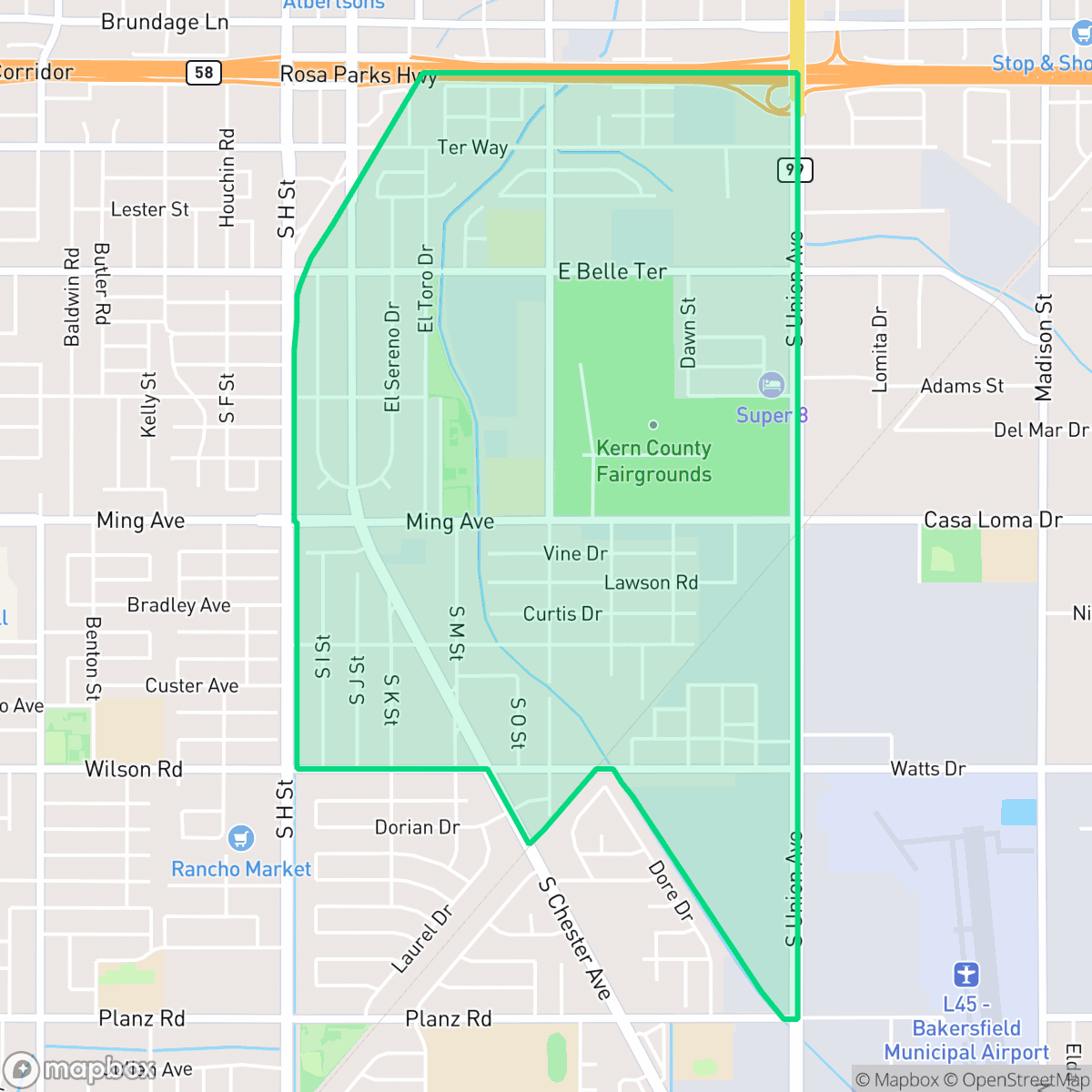
Located roughly three miles south of downtown Bakersfield, the Southgate neighborhood began developing as a residential community in 1936. The neighborhood experienced its most significant wave of growth starting in the 1950s, largely driven by the rising popularity of its primary local landmark: the Kern County Fair and Event Center. As the home of the annual Kern County Fair, this expansive venue serves as a major cultural anchor, hosting livestock shows, rodeos, and community swap meets. Architecturally, Southgate is characterized by modest mid-century single-family homes and townhomes built between 1940 and 1969. Historically, the neighborhood has maintained a strong working-class identity, with a high concentration of residents employed in agricultural, manufacturing, and service sectors, alongside a deeply rooted Mexican-American cultural heritage.
The area functions as a dense suburban grid characterized by a mix of residential blocks and significant industrial presence. Logistics hubs and warehouse facilities are common, contributing to a landscape that balances traditional single-family tract housing with active commercial corridors. Local amenities include a variety of independent eateries and community institutions, providing essential services within a modest, working-class environment.
Prospective residents should note that the neighborhood faces challenges regarding acoustic comfort, as road traffic remains a constant presence. While the grid layout allows for some pedestrian activity, the proximity to major arterial roads and industrial zones impacts overall walkability. The area is best suited for those seeking an affordable, established community with deep cultural roots, though it requires an adjustment to the higher noise levels and industrial-adjacent lifestyle typical of this part of Bakersfield.
Neighborhood Scores Across 15 Qualities
Residential spacing is typical for the area, featuring a mix of closely packed homes and suburban developments with small side yards. According to iHuus data, neighbors are situated at a similar distance to the city average.
Sidewalks are accessible within residential blocks, but major arterial roads and industrial zones create significant barriers for pedestrians. According to iHuus data, the ability to navigate the area on foot is lower than the Bakersfield average due to these high-traffic corridors.
Standard tract housing and dense apartment blocks create a highly uniform landscape with modest yards and limited greenery. This area features less visual variety and fewer luxury landscape elements than the Bakersfield average, according to iHuus data.
Walking routes for pets are constrained by narrow sidewalk verges and a lack of immediate public parks, making this area less dog friendly than the Bakersfield average. While some residents benefit from nearby fairground spaces, much of the neighborhood relies on private fenced backyards for outdoor activity.
A combination of residential grids, industrial warehouses, and open lots creates a semi-rural feel that is slightly less dense than the Bakersfield average. According to iHuus data, the landscape features a notable mix of low-density housing and significant industrial or institutional land use.
A primarily suburban and industrial landscape creates a calm atmosphere, though the limited availability of local businesses means most errands require a vehicle. According to iHuus data, the level of activity and social vibrancy in this area is slightly below the Bakersfield average.
Frequent noise from nearby railroad tracks and heavy freeway traffic characterizes this area. According to iHuus data, acoustic comfort is notably lower than the Bakersfield average.
Air quality remains generally healthy with only infrequent periods of elevated readings. This level of air purity is slightly lower than the Bakersfield average, according to iHuus data.
Light industrial and commercial units are integrated with residential areas, resulting in a higher concentration of warehouses and logistics hubs than the Bakersfield average. According to iHuus data, the eastern and northern edges of the neighborhood feature significant truck yards and large-scale storage facilities.
Health insurance accessibility is notably lower in Southgate than in the rest of Bakersfield. According to iHuus data, a significant portion of the resident population lacks employer-sponsored or private coverage.
Voting patterns and census indicators show a strong liberal lean, which is notably higher than the Bakersfield average according to iHuus data.
Residents live alongside a balanced mix of young adults, families, and older individuals. This demographic spread is largely consistent with the broader Bakersfield area, according to iHuus data.
Flood risk levels in Southgate remain undetermined because detailed federal studies for this area have not been completed. According to iHuus data, this uncertainty represents a slightly higher level of risk than the Bakersfield average.
Block-Level Insights for Southgate

iHuus Neighborhood Intelligence Insights
Get block-level neighborhood insights for Southgate
- Street-level scores — see how individual blocks compare, not just neighborhood averages
- Micro-zone boundaries — identify quiet pockets, flood boundaries, and walkable clusters before you visit
- 15 dimensions in full — walkability, noise, air quality, school quality, insurance coverage, population age profile, urban/rural index, and more
- Boundary risk alerts — know if your address sits near a block boundary where scores drop, the kind of detail no listing will ever mention
- School insights — individual school ratings and insights, not just district-level data
- Compare before you commit — side-by-side data across neighborhoods, down to block precision
No credit card required
Compare with Any Neighborhood
| Dimension | Southgate | Amberton |
|---|---|---|
| 🚶 Walkabilityavg 8.36 | ||
| 🔊 Acoustic Comfortavg 3.78 | ||
| 🤫 Privacy Indexavg 5.57 | ||
| 🎨 Visual Appealavg 6.61 | ||
| 🐕 Dog Friendlinessavg 6.03 | ||
| 🗺️ Urban-Rural Indexavg 6.87 | ||
| ✨ Neighborhood Vibeavg 4.25 | ||
| 🏥 Health Insurance Coverageavg 6.62 | ||
| 🌿 Air Qualityavg 8.49 | ||
| 🏭 Industrial Proximityavg 8.26 | ||
| 🌊 Flood Safetyavg 3.54 | ||
| 🗳️ Ideological Leanavg 5.07 | ||
| 👥 Population Age Profileavg 4.44 | ||
| 🔥 Fire Safetyavg 0.11 | ||
| 🏫 School Quality |
Southgate Rankings
School Districts Serving Southgate
Kern High School District is a robust, operationally stable organization that functions as a 'Mixed' portfolio of high-performing flagship schools and underperforming rural campuses. While the district earns praise for its Career Technical Education (CTE), high graduation rates, and competitive athletics, it is hampered by a stark disparity in academic proficiency, with several schools reporting math and reading scores well below state averages. Despite these academic gaps, strong teacher retention strategies and successful specialized programs like the Academic Decathlon indicate a stable corporate foundation that manages a diverse and geographically vast student population effectively, though it lacks the uniform excellence required for a higher rating.
Schools
Bakersfield City School District is characterized as a 'Distressed' organization where strong operational efforts in facility modernization and labor relations are overshadowed by systemic academic underperformance and stability issues. While recent investments in literacy and campus security show a commitment to improvement, the ground truth data reveals that a vast majority of the district's schools are performing at the lowest state percentiles. Frequent teacher turnover and significant concerns regarding middle school discipline suggest a fractured operational environment that has yet to translate into consistent academic success across its diverse portfolio. The district remains a system in transition, struggling to reconcile its high-performing magnets with the persistent challenges facing its Title I campuses.
Schools
School Insights for Southgate
Below average outcomes; significant attendance and academic challenges.
School Insights
See what's really behind every school rating near Southgate
- Individual school ratings — each school's own score with outcome context, not just a district average
- Enrollment & class size data — student-to-teacher ratio and how it compares to the state average
- Full demographics breakdown — ethnicity and gender composition for every school in the enrollment zone
- Every school in the district — all schools within the enrollment boundary ranked by rating, not just the closest one
- Grade levels & benchmarks — elementary through high school, with below/above state-average flags
No credit card required