San Trope, Bakersfield
Updated · 2,394 residents
San Trope is a quiet, low-density neighborhood in Bakersfield characterized by its exceptional walkability and proximity to open green spaces and small bodies of water. Residents benefit from a peaceful residential environment that remains free of industrial activity while offering convenient access to local lifestyle hubs.
Key Highlights
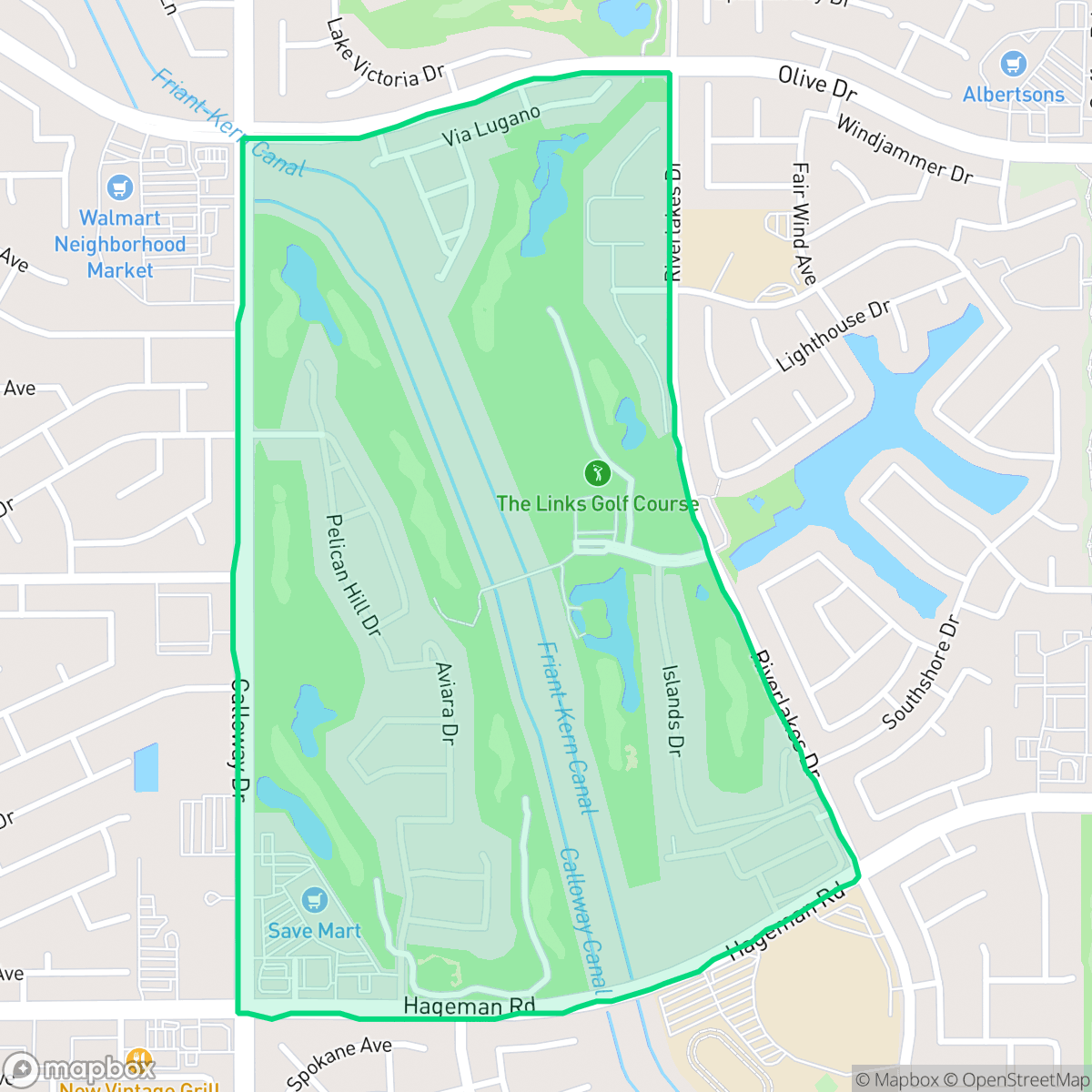
About San Trope
San Trope is a low-density residential community in Bakersfield known for its quiet atmosphere and high visual appeal. The area features well-maintained open spaces and scenic water features that contribute to a tranquil living environment. According to iHuus data, the neighborhood maintains a strong focus on residential comfort, free from industrial hazards or heavy commercial congestion, making it an attractive location for those seeking a peaceful setting. Local amenities, such as Starbucks and various dining options, provide convenient lifestyle hubs without compromising the area's calm character.
The neighborhood is highly walkable and notably dog-friendly, providing ample space for outdoor activities. While it offers a serene lifestyle, residents should be aware of the local environmental risks, including flood and fire safety considerations. The area is well-served by primary education options, such as the Fruitvale, Norris, and Rosedale Union school districts, and provides a high level of health insurance coverage for its population. It is best suited for individuals or families who prioritize a quiet, pedestrian-friendly environment over a high-energy urban nightlife.
Neighborhood Scores Across 15 Qualities
Residential spacing offers a balance of proximity and separation, providing slightly more personal distance between neighbors than the typical Bakersfield area. Backyard fencing and moderate setbacks create a degree of visual buffer between adjacent properties.
Extensive sidewalk networks and marked crosswalks make navigating the neighborhood on foot easy; according to iHuus data, this area offers superior pedestrian accessibility compared to the Bakersfield average.
Large homes, frequent backyard pools, and spacious driveways contribute to a visual landscape that is more polished than the Bakersfield average. According to iHuus data, the area features high-quality amenities and well-maintained suburban tracts.
Large park areas and wide, green-bordered paths provide much safer walking conditions for pets than the Bakersfield average. Continuous verges between sidewalks and roads offer additional space for strolls away from vehicle traffic.
Open land and scattered homes provide a slightly more rural atmosphere than the typical Bakersfield urban landscape. According to iHuus data, the area maintains a balance of suburban development and nearby fields.
Suburban streets offer a mix of quiet residential pockets and active dining hubs, providing a higher level of activity than the Bakersfield average. Residents can access various local restaurants and wellness centers, though some amenities require driving as they are not all within walking distance.
Frequent auditory disturbances from nearby railroads and major freeways are common in this area. According to iHuus data, acoustic comfort levels are lower than the Bakersfield city average.
Air quality remains mostly clean with only rare instances of elevated readings, though levels are slightly below the Bakersfield average according to iHuus data.
Industrial activity and warehouses are entirely absent from this area. According to iHuus data, the neighborhood contains only residential and light commercial zones, which is significantly cleaner than the Bakersfield average.
Health insurance accessibility is notably higher here than in the rest of Bakersfield, according to iHuus data. Most residents in this area maintain active health coverage.
Voting patterns and census indicators reflect a much more conservative political leaning than the Bakersfield average, according to iHuus data.
Residents live alongside a balanced variety of young adults, families, and seniors. This demographic distribution is slightly more varied than the average found throughout Bakersfield.
Flood risk levels for this area are slightly higher than the Bakersfield average; however, detailed FEMA studies for this specific location are currently unavailable.
Address-Level Insights for San Trope


iHuus Neighborhood Intelligence Insights
Get address-level neighborhood insights for San Trope
- Street-level scores — see how individual blocks compare, not just neighborhood averages
- Micro-zone boundaries — identify quiet pockets, flood boundaries, and walkable clusters before you visit
- 15 dimensions in full — walkability, noise, air quality, school quality, insurance coverage, population age profile, urban/rural index, and more
- Boundary risk alerts — know if your address sits near a block boundary where scores drop, the kind of detail no listing will ever mention
- School insights — individual school ratings and insights, not just district-level data
- Compare before you commit — side-by-side data across neighborhoods, down to block precision
No credit card required
Compare with Any Neighborhood
| Dimension | San Trope | Amberton |
|---|---|---|
| 🚶 Walkabilityavg 8.36 | ||
| 🔊 Acoustic Comfortavg 3.78 | ||
| 🤫 Privacy Indexavg 5.57 | ||
| 🎨 Visual Appealavg 6.61 | ||
| 🐕 Dog Friendlinessavg 6.03 | ||
| 🗺️ Urban-Rural Indexavg 6.87 | ||
| ✨ Neighborhood Vibeavg 4.25 | ||
| 🏥 Health Insurance Coverageavg 6.62 | ||
| 🌿 Air Qualityavg 8.49 | ||
| 🏭 Industrial Proximityavg 8.26 | ||
| 🌊 Flood Safetyavg 3.54 | ||
| 🗳️ Ideological Leanavg 5.07 | ||
| 👥 Population Age Profileavg 4.44 | ||
| 🔥 Fire Safetyavg 0.11 | ||
| 🏫 School Quality |
San Trope Rankings
School Districts Serving San Trope
School Insights for San Trope
Below average outcomes; significant attendance and academic challenges.
School Insights
See what's really behind every school rating near San Trope
- Individual school ratings — each school's own score with outcome context, not just a district average
- Enrollment & class size data — student-to-teacher ratio and how it compares to the state average
- Full demographics breakdown — ethnicity and gender composition for every school in the enrollment zone
- Every school in the district — all schools within the enrollment boundary ranked by rating, not just the closest one
- Grade levels & benchmarks — elementary through high school, with below/above state-average flags
No credit card required