Oleander Sunset, Bakersfield
Updated June 22, 2026 · 18,169 residents
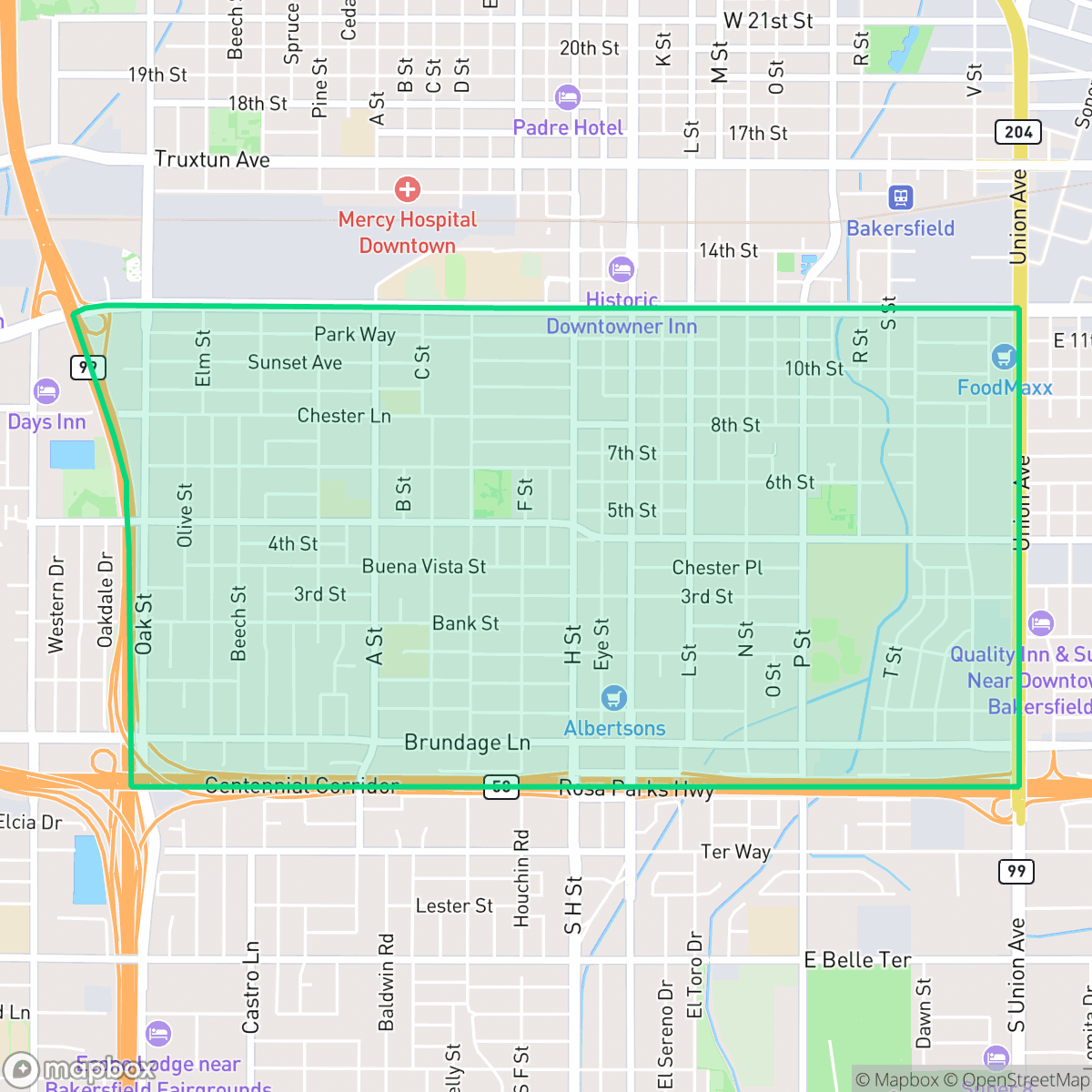
Oleander Sunset is a highly walkable community south of downtown Bakersfield, characterized by a dense grid of historic homes and established neighborhood parks. While the area offers convenient access to local dining and transit, residents experience limited privacy due to the close proximity of houses and consistent road noise.
Key Highlights
About Oleander Sunset
Located south of downtown Bakersfield, the historic Oleander-Sunset neighborhood began development in the late 1880s, eventually establishing a "millionaires row" of grand homes owned by local power brokers like publisher Alfred Harrell. Notable early estates include the 1888 Holtby mansion, later remodeled into a Southern plantation style by cotton baron W.B. Camp. In 1907, Tejon Ranch heir Truxtun Beale donated land for Beale Park—Bakersfield's first city park—which remains the neighborhood's centerpiece and features a historic 1908 Greek amphitheater. Developer Henry J. Brandt further subdivided the area in 1916, establishing the Sunset and Holtby Tracts. While early property deeds contained racially restrictive covenants, the neighborhood has evolved into a diverse, walkable community of historic bungalows, apartments, and classic residences.
The neighborhood functions as a dense, low-rise urban environment that balances its historic roots with modern suburban utility. Residents benefit from a highly connected street grid that encourages pedestrian activity, making it one of the most accessible areas in Bakersfield for those who prefer to navigate without a vehicle. The local landscape features a mix of single-family residences, apartments, and small commercial clusters, providing a diverse architectural profile that includes both vintage bungalows and standard tract housing. According to iHuus data, the area maintains a consistent level of activity, supported by various religious centers and local eateries that serve as social hubs for the community. Prospective residents should consider the trade-offs inherent in this high-density setting, which includes limited side-yard space and higher-than-average noise levels primarily driven by road traffic. While the neighborhood provides proximity to essential services and public green spaces like the historic Beale Park, the surrounding school districts face significant academic challenges that may influence family housing decisions. The area is best suited for individuals or couples who prioritize walkability and a central location over expansive private outdoor space or quiet, secluded living environments.
Neighborhood Scores Across 15 Qualities
Residential spacing is relatively tight, with many homes situated close to one another on narrow lots. This density results in a lower privacy index than the Bakersfield average according to iHuus data.
A continuous sidewalk network and clear pedestrian crossings exist on most residential and arterial streets. While the area is nearly equal to the city average for walkability, navigation is somewhat interrupted by a nearby high-speed highway.
Uniform tract housing and densely packed lots characterize the area, offering less visual variety than the Bakersfield average. Most properties feature simple roof geometries and modest yards with very few luxury amenities visible.
Public green space is primarily concentrated in nearby parks and athletic fields, while residential streets lack wide grass verges for walking pets. According to iHuus data, the availability of accessible outdoor space for dogs is lower than the Bakersfield average.
Residential blocks feature a mix of single-family homes and low-rise commercial clusters that feel slightly more developed than the city average. While some areas retain a semi-rural character with open land, the neighborhood primarily consists of a standard suburban grid.
A variety of dining options and social hubs create a more active atmosphere than much of Bakersfield. While many pockets offer a calm suburban rhythm, some areas near major highways and railways feature a more energetic, industrial-adjacent character.
Frequent acoustic disturbances from nearby railroad lines and major freeway traffic characterize this area. According to iHuus data, the level of noise is notably higher than the Bakersfield average.
Air quality remains generally high with infrequent periods of elevated readings, though it sits slightly below the Bakersfield average according to iHuus data.
Industrial presence is minimal, though residents near the eastern edges or rail lines may experience noise from warehouses and active transit. Aside from occasional light commercial zones, the area lacks heavy industrial complexes or large-scale hazardous storage, making it slightly more industrial-adjacent than the Bakersfield average.
Access to health insurance is notably lower here than the Bakersfield average. According to iHuus data, fewer residents in this area maintain coverage compared to the rest of the city.
Political leanings in this area are predominantly liberal, representing a more progressive tilt than the Bakersfield average according to iHuus data.
Residents live alongside a balanced variety of young adults, families, and older populations. This demographic spread is consistent with the broader Bakersfield area, according to iHuus data.
Flood risk in this area is elevated because parts of the neighborhood sit within a 100-year floodplain. According to iHuus data, this level of risk is slightly higher than the Bakersfield average and may necessitate flood insurance.
Block-Level Insights for Oleander Sunset

iHuus Neighborhood Intelligence Insights
Get block-level neighborhood insights for Oleander Sunset
- Street-level scores — see how individual blocks compare, not just neighborhood averages
- Micro-zone boundaries — identify quiet pockets, flood boundaries, and walkable clusters before you visit
- 15 dimensions in full — walkability, noise, air quality, school quality, insurance coverage, population age profile, urban/rural index, and more
- Boundary risk alerts — know if your address sits near a block boundary where scores drop, the kind of detail no listing will ever mention
- School insights — individual school ratings and insights, not just district-level data
- Compare before you commit — side-by-side data across neighborhoods, down to block precision
No credit card required
Compare with Any Neighborhood
| Dimension | Oleander Sunset | Amberton |
|---|---|---|
| 🚶 Walkabilityavg 8.36 | ||
| 🔊 Acoustic Comfortavg 3.78 | ||
| 🤫 Privacy Indexavg 5.57 | ||
| 🎨 Visual Appealavg 6.61 | ||
| 🐕 Dog Friendlinessavg 6.03 | ||
| 🗺️ Urban-Rural Indexavg 6.87 | ||
| ✨ Neighborhood Vibeavg 4.25 | ||
| 🏥 Health Insurance Coverageavg 6.62 | ||
| 🌿 Air Qualityavg 8.49 | ||
| 🏭 Industrial Proximityavg 8.26 | ||
| 🌊 Flood Safetyavg 3.54 | ||
| 🗳️ Ideological Leanavg 5.07 | ||
| 👥 Population Age Profileavg 4.44 | ||
| 🔥 Fire Safetyavg 0.11 | ||
| 🏫 School Quality |
Oleander Sunset Rankings
School Districts Serving Oleander Sunset
Kern High School District is a robust, operationally stable organization that functions as a 'Mixed' portfolio of high-performing flagship schools and underperforming rural campuses. While the district earns praise for its Career Technical Education (CTE), high graduation rates, and competitive athletics, it is hampered by a stark disparity in academic proficiency, with several schools reporting math and reading scores well below state averages. Despite these academic gaps, strong teacher retention strategies and successful specialized programs like the Academic Decathlon indicate a stable corporate foundation that manages a diverse and geographically vast student population effectively, though it lacks the uniform excellence required for a higher rating.
Schools
Bakersfield City School District is characterized as a 'Distressed' organization where strong operational efforts in facility modernization and labor relations are overshadowed by systemic academic underperformance and stability issues. While recent investments in literacy and campus security show a commitment to improvement, the ground truth data reveals that a vast majority of the district's schools are performing at the lowest state percentiles. Frequent teacher turnover and significant concerns regarding middle school discipline suggest a fractured operational environment that has yet to translate into consistent academic success across its diverse portfolio. The district remains a system in transition, struggling to reconcile its high-performing magnets with the persistent challenges facing its Title I campuses.
Schools
School Insights for Oleander Sunset
Below average outcomes; significant attendance and academic challenges.
School Insights
See what's really behind every school rating near Oleander Sunset
- Individual school ratings — each school's own score with outcome context, not just a district average
- Enrollment & class size data — student-to-teacher ratio and how it compares to the state average
- Full demographics breakdown — ethnicity and gender composition for every school in the enrollment zone
- Every school in the district — all schools within the enrollment boundary ranked by rating, not just the closest one
- Grade levels & benchmarks — elementary through high school, with below/above state-average flags
No credit card required