Northeast Bakersfield, Bakersfield
Updated June 22, 2026 · 7,052 residents
Northeast Bakersfield is defined by its elevated bluff-side topography and established, quiet residential streets. Residents benefit from exceptional walkability and a tranquil acoustic environment, making it a stable choice for those seeking a peaceful suburban lifestyle.
Key Highlights
About Northeast Bakersfield
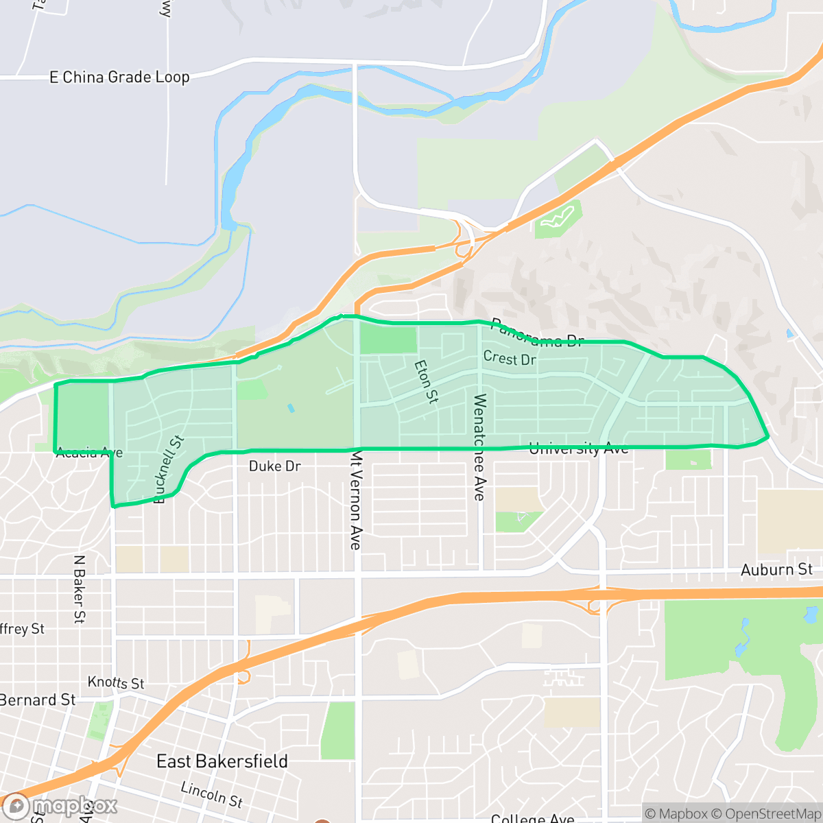
Northeast Bakersfield, bounded by the Kern River and Panorama Drive, experienced its initial surge of development prior to World War II, accelerating through the late 1970s. The region became a premier residential area, with the homes along the bluffs of Panorama Drive and the Bakersfield Country Club historically serving as some of the city's most affluent enclaves. A major catalyst for growth was the relocation of Bakersfield College to its current Panorama Drive campus in 1956, a move accelerated by urban renewal efforts following the devastating 1952 Kern County earthquake. This established the College Heights neighborhood as a prominent residential and educational hub. For decades, the area's commercial and social anchor was the East Hills Mall, which opened in 1988 before eventually closing and being demolished.
The area maintains a distinct suburban character, characterized by well-maintained lawns and private residential amenities. With high marks for acoustic comfort and air quality, the neighborhood offers a serene living environment that contrasts with the more bustling parts of the city. While it functions primarily as a residential hub, the proximity to green spaces and institutional landmarks like the Grace Van Dyke Bird Library provides essential community infrastructure. According to iHuus data, the neighborhood features a consistent sidewalk network, facilitating easy pedestrian access throughout the residential grid.
Prospective residents should note that while the area is quiet, it lacks a high density of commercial activity, often requiring travel for daily errands. The neighborhood is particularly well-suited for families and individuals who prioritize a calm atmosphere over immediate access to urban nightlife. Potential buyers should be aware of environmental considerations, as regional data indicates significant challenges regarding flood and fire safety. While the local educational landscape is mixed, the area remains a stable, long-standing community for those looking to settle in a mature suburban setting.
Neighborhood Scores Across 15 Qualities
Residential spacing is consistent with the city average, featuring detached homes with standard side-yard buffers. Some areas contain denser suburban tracts where houses sit in closer proximity to one another.
Continuous sidewalks and clear pedestrian crossings define the residential grid, making the area significantly more walkable than the Bakersfield average. Extensive sidewalk networks on both sides of the streets provide safe and connected paths for residents.
Well-maintained homes and a high frequency of private backyard pools create a more polished visual environment than the Bakersfield average. According to iHuus data, the area is characterized by large properties and spacious driveways.
Access to central public parks and grassy verges between sidewalks and roads provides more space for pets than the city average. According to iHuus data, certain pockets offer significant open green space, though some residential areas rely solely on private backyards.
Open landscapes and vast green spaces characterize this area, offering a suburban fringe feel that is slightly less dense than the Bakersfield average. Residential pockets transition into large riverbed areas, parklands, and undeveloped hillsides.
A mix of calm suburban blocks and lively social hubs provides a more active atmosphere than the Bakersfield average. Local dining and parks like Siemon Park offer pockets of activity, though some outlying areas remain quiet and car-dependent.
Acoustic levels are notably lower than the Bakersfield average, with sounds limited to infrequent trains or distant vehicle traffic. According to iHuus data, this area maintains a much higher level of acoustic comfort than most parts of the city.
Air quality remains mostly clean with rare instances of elevated readings, though it is slightly lower than the Bakersfield average according to iHuus data.
Residential life here is largely uninterrupted by heavy industry, warehouses, or hazardous facilities. According to iHuus data, this area maintains a cleaner profile than the Bakersfield average, with only light utility structures and small commercial buffers present.
Health insurance accessibility is notably higher here than the Bakersfield average, according to iHuus data.
Political leanings in this area are split nearly evenly between conservative and liberal perspectives, representing a more moderate landscape than the city average according to iHuus data.
A balanced mix of young adults, families, and older residents defines the area. This demographic distribution is largely consistent with the broader Bakersfield average, according to iHuus data.
Flood vulnerability in this area is significantly higher than the Bakersfield average, according to iHuus data. Residents should be aware of heightened seasonal water risks when considering property in this part of the city.
Elevated fire hazards persist in this area, representing a higher risk level than the Bakersfield average. Residents should prioritize maximum fire protection measures according to iHuus data.
Block-Level Insights for Northeast Bakersfield

iHuus Neighborhood Intelligence Insights
Get block-level neighborhood insights for Northeast Bakersfield
- Street-level scores — see how individual blocks compare, not just neighborhood averages
- Micro-zone boundaries — identify quiet pockets, flood boundaries, and walkable clusters before you visit
- 15 dimensions in full — walkability, noise, air quality, school quality, insurance coverage, population age profile, urban/rural index, and more
- Boundary risk alerts — know if your address sits near a block boundary where scores drop, the kind of detail no listing will ever mention
- School insights — individual school ratings and insights, not just district-level data
- Compare before you commit — side-by-side data across neighborhoods, down to block precision
No credit card required
Compare with Any Neighborhood
| Dimension | Northeast Bakersfield | Amberton |
|---|---|---|
| 🚶 Walkabilityavg 8.36 | ||
| 🔊 Acoustic Comfortavg 3.78 | ||
| 🤫 Privacy Indexavg 5.57 | ||
| 🎨 Visual Appealavg 6.61 | ||
| 🐕 Dog Friendlinessavg 6.03 | ||
| 🗺️ Urban-Rural Indexavg 6.87 | ||
| ✨ Neighborhood Vibeavg 4.25 | ||
| 🏥 Health Insurance Coverageavg 6.62 | ||
| 🌿 Air Qualityavg 8.49 | ||
| 🏭 Industrial Proximityavg 8.26 | ||
| 🌊 Flood Safetyavg 3.54 | ||
| 🗳️ Ideological Leanavg 5.07 | ||
| 👥 Population Age Profileavg 4.44 | ||
| 🔥 Fire Safetyavg 0.11 | ||
| 🏫 School Quality |
Northeast Bakersfield Rankings
School Districts Serving Northeast Bakersfield
Kern High School District is a robust, operationally stable organization that functions as a 'Mixed' portfolio of high-performing flagship schools and underperforming rural campuses. While the district earns praise for its Career Technical Education (CTE), high graduation rates, and competitive athletics, it is hampered by a stark disparity in academic proficiency, with several schools reporting math and reading scores well below state averages. Despite these academic gaps, strong teacher retention strategies and successful specialized programs like the Academic Decathlon indicate a stable corporate foundation that manages a diverse and geographically vast student population effectively, though it lacks the uniform excellence required for a higher rating.
Schools
Bakersfield City School District is characterized as a 'Distressed' organization where strong operational efforts in facility modernization and labor relations are overshadowed by systemic academic underperformance and stability issues. While recent investments in literacy and campus security show a commitment to improvement, the ground truth data reveals that a vast majority of the district's schools are performing at the lowest state percentiles. Frequent teacher turnover and significant concerns regarding middle school discipline suggest a fractured operational environment that has yet to translate into consistent academic success across its diverse portfolio. The district remains a system in transition, struggling to reconcile its high-performing magnets with the persistent challenges facing its Title I campuses.
Schools
School Insights for Northeast Bakersfield
Below average outcomes; significant attendance and academic challenges.
School Insights
See what's really behind every school rating near Northeast Bakersfield
- Individual school ratings — each school's own score with outcome context, not just a district average
- Enrollment & class size data — student-to-teacher ratio and how it compares to the state average
- Full demographics breakdown — ethnicity and gender composition for every school in the enrollment zone
- Every school in the district — all schools within the enrollment boundary ranked by rating, not just the closest one
- Grade levels & benchmarks — elementary through high school, with below/above state-average flags
No credit card required