Downtown, Bakersfield
Updated June 22, 2026 · 3,927 residents
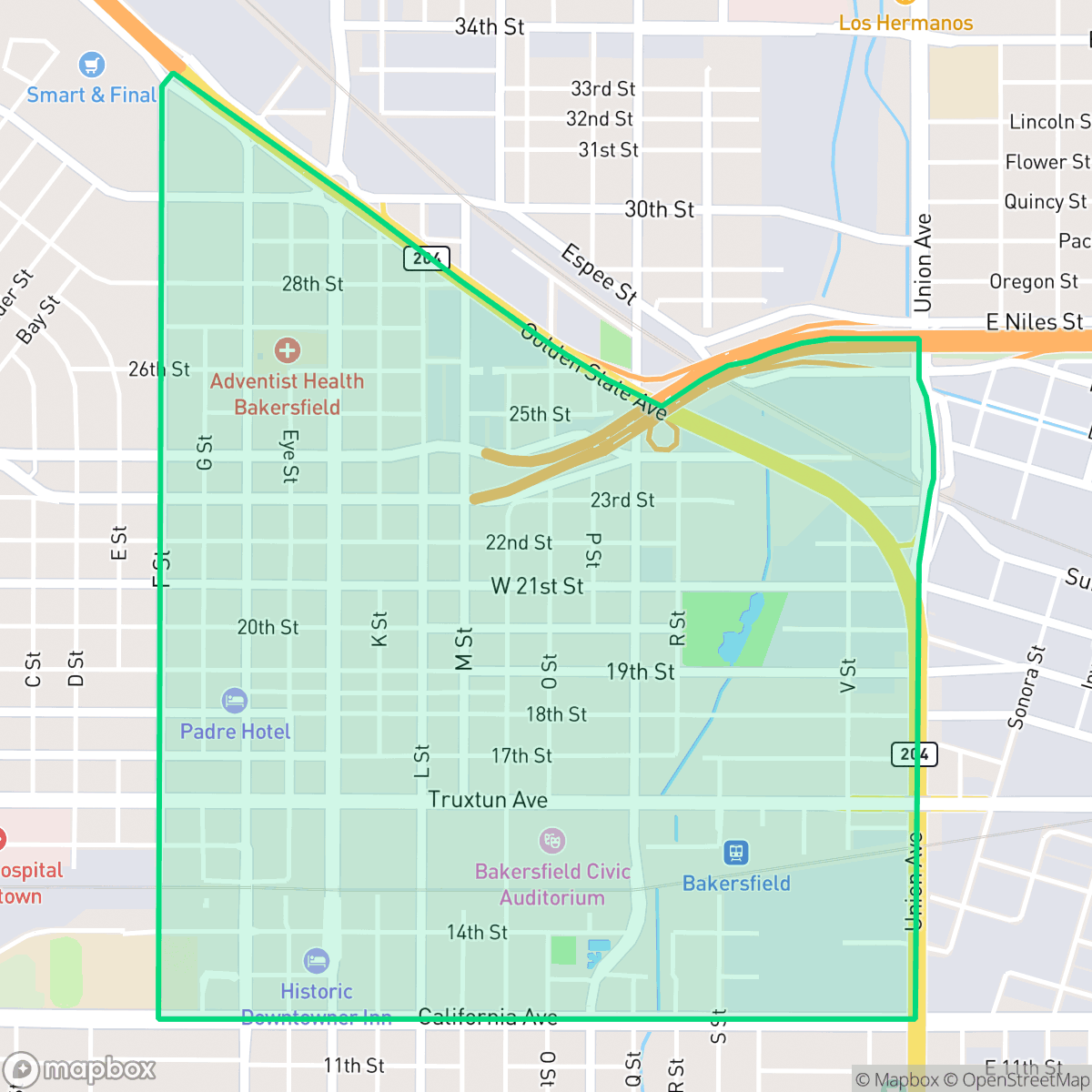
Downtown Bakersfield serves as a cultural and artistic anchor, defined by its historic architecture and a vibrant, moderately walkable commercial core. While the district offers a lively environment with diverse dining and entertainment, residents should anticipate high noise levels from nearby transit and a dense, utilitarian landscape.
Key Highlights
About Downtown
Downtown Bakersfield was established in 1869 by Thomas Baker, who reclaimed local swamplands to create a grid-patterned commercial core. The neighborhood’s architectural landscape was profoundly reshaped by the 1952 Kern County earthquake, which necessitated extensive reconstruction and the reinforcement of historic structures. Today, the area preserves a distinctive mix of styles, including the Spanish Colonial Revival architecture of the 1928 Padre Hotel and the Art Deco grandeur of the 1930 Fox Theater. Other notable landmarks, such as the 1926 Bakersfield Californian Building and the turn-of-the-20th-century Tevis Block, reflect the district's history as a regional economic and journalistic hub. Centered on streets like Chester Avenue, the downtown area remains a cultural anchor, featuring an established Arts District that highlights the neighborhood's transition from an early agricultural and oil-boom center to a modern civic and artistic destination.
The neighborhood functions as a dense urban center characterized by a grid of commercial blocks and residential pockets. It provides a unique atmosphere for those who value proximity to local museums, social hubs, and the arts, though the built environment is largely utilitarian with limited private outdoor space. The area maintains a distinct identity through its mix of historic structures and modern civic activity, attracting a diverse demographic of residents who appreciate a more liberal-leaning community.
Prospective residents should consider the trade-offs of living in a central hub, as the proximity to active freight corridors and major highways results in a consistently noisy acoustic environment. The area is moderately walkable for daily errands, yet remains largely car-dependent due to the surrounding industrial layout. Families should be aware of the academic challenges within the local school districts, and those seeking pet-friendly amenities may find the lack of public green space and narrow sidewalks restrictive. Additionally, the neighborhood is situated within a floodplain, necessitating careful consideration of insurance requirements.
Neighborhood Scores Across 15 Qualities
Residential spacing varies throughout the area, with some high-density lots featuring houses placed closely together along shared alleys. According to iHuus data, this level of seclusion is slightly lower than the Bakersfield average.
Sidewalks and marked crosswalks are available on many streets, though overall walkability is lower than the Bakersfield average. Pedestrian movement is supported by a consistent grid in specific residential and commercial sections according to iHuus data.
Standard tract housing with boxy roofs and small yards characterizes the area, making the visual landscape less lush than the Bakersfield average according to iHuus data.
Minimal public green space and narrow sidewalk verges make walking pets difficult. Most available outdoor areas for dogs consist of private fenced yards, which is notably lower than the city average according to iHuus data.
Urban development and commercial blocks dominate the landscape, presenting a more built-up environment than the city average. According to iHuus data, the area features a high ratio of paved surfaces and industrial structures interspersed with low-rise residential grids.
A varied mix of dining, museums, and social hubs creates an energetic atmosphere that is noticeably more active than the Bakersfield average. While the area offers many local eateries and green spaces, much of the layout remains car-dependent due to the presence of industrial blocks and major highways.
Frequent sound from nearby railroad tracks and heavy freeway traffic creates a much louder environment than the rest of Bakersfield. According to iHuus data, this area experiences significantly more acoustic disturbance than the city average.
Air quality remains mostly clean with only rare instances of elevated readings; however, levels are slightly below the Bakersfield city average according to iHuus data.
Active rail lines and commercial warehouses introduce more industrial activity and traffic than is typically found in other parts of Bakersfield. According to iHuus data, this area features a blend of residential pockets alongside logistics hubs and freight corridors.
Health insurance coverage among residents is significantly lower than the Bakersfield average, according to iHuus data. This lack of coverage may present challenges for accessing routine medical care and managing healthcare costs.
Political leanings in this area skew more liberal than the Bakersfield average, according to iHuus data.
A balanced mix of young adults, families, and older residents characterizes this area. According to iHuus data, the age distribution remains consistent with the broader Bakersfield average.
Located within a known floodplain, this area presents a greater flood risk than the Bakersfield average. According to iHuus data, properties in this neighborhood are likely to require flood insurance due to their proximity to mapped flood zones.
Block-Level Insights for Downtown

iHuus Neighborhood Intelligence Insights
Get block-level neighborhood insights for Downtown
- Street-level scores — see how individual blocks compare, not just neighborhood averages
- Micro-zone boundaries — identify quiet pockets, flood boundaries, and walkable clusters before you visit
- 15 dimensions in full — walkability, noise, air quality, school quality, insurance coverage, population age profile, urban/rural index, and more
- Boundary risk alerts — know if your address sits near a block boundary where scores drop, the kind of detail no listing will ever mention
- School insights — individual school ratings and insights, not just district-level data
- Compare before you commit — side-by-side data across neighborhoods, down to block precision
No credit card required
Compare with Any Neighborhood
| Dimension | Downtown | Amberton |
|---|---|---|
| 🚶 Walkabilityavg 8.36 | ||
| 🔊 Acoustic Comfortavg 3.78 | ||
| 🤫 Privacy Indexavg 5.57 | ||
| 🎨 Visual Appealavg 6.61 | ||
| 🐕 Dog Friendlinessavg 6.03 | ||
| 🗺️ Urban-Rural Indexavg 6.87 | ||
| ✨ Neighborhood Vibeavg 4.25 | ||
| 🏥 Health Insurance Coverageavg 6.62 | ||
| 🌿 Air Qualityavg 8.49 | ||
| 🏭 Industrial Proximityavg 8.26 | ||
| 🌊 Flood Safetyavg 3.54 | ||
| 🗳️ Ideological Leanavg 5.07 | ||
| 👥 Population Age Profileavg 4.44 | ||
| 🔥 Fire Safetyavg 0.11 | ||
| 🏫 School Quality |
Downtown Rankings
School Districts Serving Downtown
Kern High School District is a robust, operationally stable organization that functions as a 'Mixed' portfolio of high-performing flagship schools and underperforming rural campuses. While the district earns praise for its Career Technical Education (CTE), high graduation rates, and competitive athletics, it is hampered by a stark disparity in academic proficiency, with several schools reporting math and reading scores well below state averages. Despite these academic gaps, strong teacher retention strategies and successful specialized programs like the Academic Decathlon indicate a stable corporate foundation that manages a diverse and geographically vast student population effectively, though it lacks the uniform excellence required for a higher rating.
Schools
Bakersfield City School District is characterized as a 'Distressed' organization where strong operational efforts in facility modernization and labor relations are overshadowed by systemic academic underperformance and stability issues. While recent investments in literacy and campus security show a commitment to improvement, the ground truth data reveals that a vast majority of the district's schools are performing at the lowest state percentiles. Frequent teacher turnover and significant concerns regarding middle school discipline suggest a fractured operational environment that has yet to translate into consistent academic success across its diverse portfolio. The district remains a system in transition, struggling to reconcile its high-performing magnets with the persistent challenges facing its Title I campuses.
Schools
School Insights for Downtown
Below average outcomes; significant attendance and academic challenges.
School Insights
See what's really behind every school rating near Downtown
- Individual school ratings — each school's own score with outcome context, not just a district average
- Enrollment & class size data — student-to-teacher ratio and how it compares to the state average
- Full demographics breakdown — ethnicity and gender composition for every school in the enrollment zone
- Every school in the district — all schools within the enrollment boundary ranked by rating, not just the closest one
- Grade levels & benchmarks — elementary through high school, with below/above state-average flags
No credit card required