College Heights - Baker Street, Bakersfield
Updated June 22, 2026 · 2,283 residents
College Heights - Baker Street offers a blend of academic proximity and historic commercial roots, characterized by a dense suburban grid and high accessibility to local amenities. While the area provides high rates of health insurance coverage and a lack of heavy industrial proximity, residents should anticipate notable noise levels from road traffic and limited privacy due to tightly spaced housing.
Key Highlights
About College Heights - Baker Street
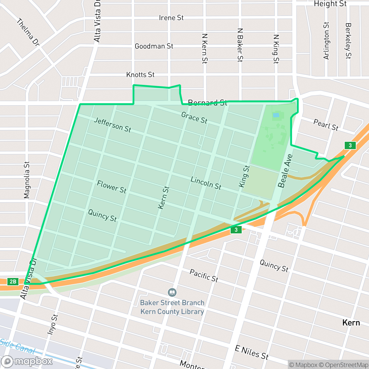
The College Heights - Baker Street neighborhood in Bakersfield, California, is historically anchored by two major local landmarks. Its northern focal point is Bakersfield College, which established its permanent campus here in 1956, driving residential growth throughout the 1950s. To the south, the neighborhood transitions into the historic Old Town Kern area along Baker Street. Originally founded in 1874 as the railroad town of Sumner (later renamed Kern City) following a land dispute between local leaders and the Southern Pacific Railroad, this southern corridor became a competitive commercial hub. It attracted a diverse population, notably Basque and Italian immigrants who established enduring local businesses, hotels, and bakeries. The neighborhood is also home to the historic Baker Street Branch Library, an Italian Renaissance-style Greek Revival building completed in 1915 and listed on the National Register of Historic Places.
The neighborhood functions as a central residential hub that bridges the academic environment near Bakersfield College with the historic commercial corridor of Old Town Kern. The streetscape features a consistent grid pattern that supports moderate walkability, allowing residents to navigate between local services and green spaces with relative ease. The area maintains a stable residential profile, and according to iHuus data, it benefits from high health insurance coverage, reflecting a community that is well-integrated into the broader Bakersfield infrastructure.
Prospective residents should weigh the benefits of this central location against specific environmental trade-offs. The proximity to major thoroughfares results in elevated noise levels, and the compact nature of the housing stock provides limited space between individual properties. Given the current school district performance metrics and environmental safety scores, the area is best suited for those prioritizing location and access to established community landmarks over absolute quiet or top-tier academic performance.
Neighborhood Scores Across 15 Qualities
Homes in this area feature mixed spacing with some neighbors positioned closely together. This level of residential density is slightly lower than the Bakersfield average, providing some buffer between properties.
Pedestrian movement is supported by a dense grid of sidewalks and marked crosswalks, though nearby rail tracks and industrial zones can act as obstacles. This level of connectivity is slightly below the city average for Bakersfield.
Standard tract housing characterizes this area, featuring uniform rooflines and modest yard spaces. According to iHuus data, the visual landscape is less varied than the Bakersfield average due to a prevalence of small lots and minimal luxury amenities.
Walking opportunities for dogs are somewhat restricted due to a lack of green verges, though some areas benefit from proximity to a large public park. According to iHuus data, the availability of dedicated pet space is lower than the Bakersfield average.
Open land and scattered homes provide a more semi-rural atmosphere than the typical Bakersfield urban setting. This character is defined by a mix of residential blocks and significant industrial or rail infrastructure according to iHuus data.
A balanced mix of dining, religious institutions, and residential pockets provides more activity than the typical Bakersfield area. According to iHuus data, the neighborhood features a consistent flow of services near major transit corridors alongside quieter green spaces.
Persistent noise from nearby airport and heavy rail infrastructure makes this area significantly louder than most of Bakersfield. Residents can expect frequent auditory disruptions due to the proximity of major transit corridors.
Air quality remains mostly clean with only rare instances of elevated readings, though it is slightly below the Bakersfield average according to iHuus data.
Residential life here is largely undisturbed by heavy industry, as the area contains mostly residential and light commercial uses. According to iHuus data, the level of industrial proximity is nearly identical to the Bakersfield average.
Health insurance coverage in this area is slightly below the Bakersfield average. According to iHuus data, a portion of the resident population lacks coverage, which may impact local access to preventative care.
Residents will find a liberal-leaning community that is notably more progressive than the Bakersfield average, according to iHuus data.
Residents live alongside a balanced mix of young adults, families, and seniors. This demographic variety is slightly lower than the average seen across Bakersfield.
Block-Level Insights for College Heights - Baker Street

iHuus Neighborhood Intelligence Insights
Get block-level neighborhood insights for College Heights - Baker Street
- Street-level scores — see how individual blocks compare, not just neighborhood averages
- Micro-zone boundaries — identify quiet pockets, flood boundaries, and walkable clusters before you visit
- 15 dimensions in full — walkability, noise, air quality, school quality, insurance coverage, population age profile, urban/rural index, and more
- Boundary risk alerts — know if your address sits near a block boundary where scores drop, the kind of detail no listing will ever mention
- School insights — individual school ratings and insights, not just district-level data
- Compare before you commit — side-by-side data across neighborhoods, down to block precision
No credit card required
Compare with Any Neighborhood
| Dimension | College Heights - Baker Street | Amberton |
|---|---|---|
| 🚶 Walkabilityavg 8.36 | ||
| 🔊 Acoustic Comfortavg 3.78 | ||
| 🤫 Privacy Indexavg 5.57 | ||
| 🎨 Visual Appealavg 6.61 | ||
| 🐕 Dog Friendlinessavg 6.03 | ||
| 🗺️ Urban-Rural Indexavg 6.87 | ||
| ✨ Neighborhood Vibeavg 4.25 | ||
| 🏥 Health Insurance Coverageavg 6.62 | ||
| 🌿 Air Qualityavg 8.49 | ||
| 🏭 Industrial Proximityavg 8.26 | ||
| 🌊 Flood Safetyavg 3.54 | ||
| 🗳️ Ideological Leanavg 5.07 | ||
| 👥 Population Age Profileavg 4.44 | ||
| 🔥 Fire Safetyavg 0.11 | ||
| 🏫 School Quality |
College Heights - Baker Street Rankings
School Districts Serving College Heights - Baker Street
Kern High School District is a robust, operationally stable organization that functions as a 'Mixed' portfolio of high-performing flagship schools and underperforming rural campuses. While the district earns praise for its Career Technical Education (CTE), high graduation rates, and competitive athletics, it is hampered by a stark disparity in academic proficiency, with several schools reporting math and reading scores well below state averages. Despite these academic gaps, strong teacher retention strategies and successful specialized programs like the Academic Decathlon indicate a stable corporate foundation that manages a diverse and geographically vast student population effectively, though it lacks the uniform excellence required for a higher rating.
Schools
Bakersfield City School District is characterized as a 'Distressed' organization where strong operational efforts in facility modernization and labor relations are overshadowed by systemic academic underperformance and stability issues. While recent investments in literacy and campus security show a commitment to improvement, the ground truth data reveals that a vast majority of the district's schools are performing at the lowest state percentiles. Frequent teacher turnover and significant concerns regarding middle school discipline suggest a fractured operational environment that has yet to translate into consistent academic success across its diverse portfolio. The district remains a system in transition, struggling to reconcile its high-performing magnets with the persistent challenges facing its Title I campuses.
Schools
School Insights for College Heights - Baker Street
Below average outcomes; significant attendance and academic challenges.
School Insights
See what's really behind every school rating near College Heights - Baker Street
- Individual school ratings — each school's own score with outcome context, not just a district average
- Enrollment & class size data — student-to-teacher ratio and how it compares to the state average
- Full demographics breakdown — ethnicity and gender composition for every school in the enrollment zone
- Every school in the district — all schools within the enrollment boundary ranked by rating, not just the closest one
- Grade levels & benchmarks — elementary through high school, with below/above state-average flags
No credit card required