Platinum Triangle, Anaheim
Updated · 5,670 residents
The Platinum Triangle is a high-density, transit-oriented district in Anaheim defined by its proximity to major sports venues and a mix of modern residential and industrial zones. While it offers convenient access to regional transit and local dining, the area is characterized by significant road noise and a car-dependent layout that limits pedestrian accessibility.
Key Highlights
About Platinum Triangle
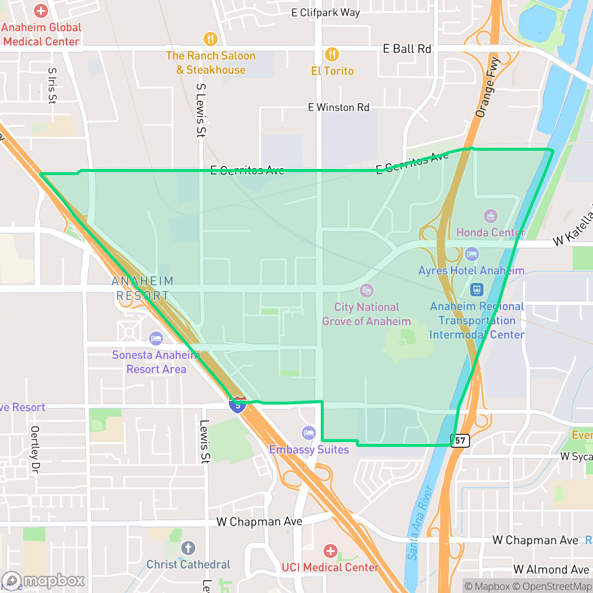
The Platinum Triangle is an 820-acre district in Anaheim, California, bounded roughly by Interstate 5, the Santa Ana River, and Cerritos Avenue. Originally a hub of agricultural farms and low-density industrial sites, the area underwent a major transformation starting in 2004 when the city rezoned the district to foster high-density, mixed-use urban development. Designed to serve as a modern downtown hub for Orange County, the neighborhood is anchored by prominent landmarks including Angel Stadium of Anaheim, the Honda Center, and the City National Grove of Anaheim. The Stadium Lofts, breaking ground in 2004, marked the district's first major mixed-use residential project. Today, the Platinum Triangle continues its evolution from an industrial zone into a bustling transit-oriented community, supported by the Anaheim Regional Transportation Intermodal Center (ARTIC).
The neighborhood functions as a modern urban core within Orange County, balancing large-scale commercial infrastructure with high-density residential developments. Residents benefit from high rates of health insurance coverage and proximity to major transit hubs like the Anaheim Regional Transportation Intermodal Center. The landscape is primarily defined by its concrete-heavy aesthetic, featuring a mix of office parks, light industrial warehouses, and multi-story apartment complexes. Living in this district requires navigating trade-offs, particularly regarding acoustic comfort and privacy. According to iHuus data, the area experiences notable noise from nearby highways and freight traffic, and the dense, industrial-adjacent environment results in limited outdoor amenities for pet owners. It is best suited for professionals who prioritize transit access and proximity to central employment hubs over the quiet, low-density atmosphere found in traditional suburban residential zones.
Neighborhood Scores Across 15 Qualities
Residential structures and mobile homes are positioned with minimal separation, resulting in lower privacy levels than the Anaheim average. According to iHuus data, many units share walls or sit in very close proximity to one another.
Sidewalks are available on many streets, but large industrial lots and massive freeway interchanges act as significant barriers to movement. This connectivity is notably lower than the Anaheim average according to iHuus data.
Standard tract housing, apartment complexes, and mobile home parks create a utilitarian landscape with repetitive roof geometries. According to iHuus data, the visual variety in this area is slightly below the Anaheim average.
Public parks and grassy areas near apartments offer some walking options, but the lack of wide sidewalk verges makes this area less dog friendly than the Anaheim average. According to iHuus data, many residential streets lack the greenery typically used for easy pet exercise.
Extensive industrial, commercial, and high-density residential zones create a highly developed landscape. According to iHuus data, the built environment in this area is consistent with the city average in terms of its urban-to-rural balance.
A steady rhythm of services and dining exists alongside warehouses and railways, though the area is primarily car-dependent. This level of activity is roughly consistent with the average for Anaheim.
Constant aircraft noise from nearby runways and heavy rail activity makes this area significantly noisier than the rest of Anaheim. Residents should expect very low acoustic comfort according to iHuus data.
Air quality remains largely clear with infrequent periods of elevated readings. This level of air purity is slightly lower than the average found throughout Anaheim, according to iHuus data.
Light industrial and commercial activity is present alongside residential areas, resulting in a lower level of industrial density than the Anaheim average. Residents may encounter occasional operational noise or delivery traffic from nearby warehouses and service-oriented businesses.
Health insurance access among residents is slightly above the Anaheim average, according to iHuus data.
Voting patterns and census indicators reflect a significantly more liberal political leaning than the Anaheim average, according to iHuus data.
A varied demographic of young professionals, families, and seniors resides here. According to iHuus data, this age distribution is slightly more concentrated in certain age brackets compared to the broader Anaheim area.
Properties in this area are located within a designated floodplain, meaning residents may face a higher risk of flooding than the average Anaheim neighborhood. According to iHuus data, flood insurance is typically required for homes in this zone.
Address-Level Insights for Platinum Triangle


iHuus Neighborhood Intelligence Insights
Get address-level neighborhood insights for Platinum Triangle
- Street-level scores — see how individual blocks compare, not just neighborhood averages
- Micro-zone boundaries — identify quiet pockets, flood boundaries, and walkable clusters before you visit
- 15 dimensions in full — walkability, noise, air quality, school quality, insurance coverage, population age profile, urban/rural index, and more
- Boundary risk alerts — know if your address sits near a block boundary where scores drop, the kind of detail no listing will ever mention
- School insights — individual school ratings and insights, not just district-level data
- Compare before you commit — side-by-side data across neighborhoods, down to block precision
No credit card required
Compare with Any Neighborhood
| Dimension | Platinum Triangle | Anaheim Hills |
|---|---|---|
| 🚶 Walkabilityavg 8.73 | ||
| 🔊 Acoustic Comfortavg 2.38 | ||
| 🤫 Privacy Indexavg 4.69 | ||
| 🎨 Visual Appealavg 6.56 | ||
| 🐕 Dog Friendlinessavg 5.82 | ||
| 🗺️ Urban-Rural Indexavg 6.49 | ||
| ✨ Neighborhood Vibeavg 4.29 | ||
| 🏥 Health Insurance Coverageavg 6.54 | ||
| 🌿 Air Qualityavg 8.7 | ||
| 🏭 Industrial Proximityavg 8.17 | ||
| 🌊 Flood Safetyavg 2.02 | ||
| 🗳️ Ideological Leanavg 7.03 | ||
| 👥 Population Age Profileavg 4.79 | ||
| 🔥 Fire Safetyavg 0.06 | ||
| 🏫 School Quality |
Platinum Triangle Rankings
School Districts Serving Platinum Triangle
School Insights for Platinum Triangle
Below average outcomes; significant attendance and academic challenges.
School Insights
See what's really behind every school rating near Platinum Triangle
- Individual school ratings — each school's own score with outcome context, not just a district average
- Enrollment & class size data — student-to-teacher ratio and how it compares to the state average
- Full demographics breakdown — ethnicity and gender composition for every school in the enrollment zone
- Every school in the district — all schools within the enrollment boundary ranked by rating, not just the closest one
- Grade levels & benchmarks — elementary through high school, with below/above state-average flags
No credit card required