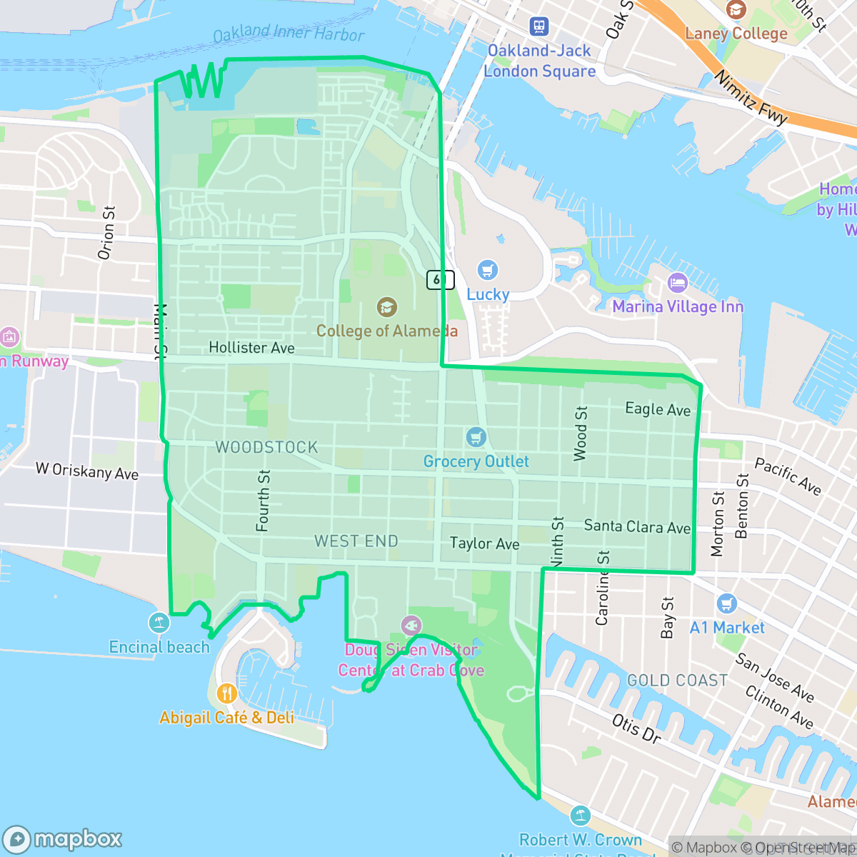
West End, Alameda
Updated June 22, 2026 · 16,090 residents
The West End is a highly walkable neighborhood in Alameda known for its dense residential blocks, diverse local eateries, and proximity to waterfront trails. While it offers excellent access to schools and community parks, residents should expect a higher level of road noise and limited privacy due to the close proximity of homes and multi-family complexes.
Key Highlights
About West End
Originally known as Bowman’s Point and later Woodstock, the West End of Alameda developed as a gritty, industrial, and recreational counterpoint to the city’s more conservative core. Webster Street, the neighborhood’s historic commercial spine, hosted a lively mix of saloons, including the landmark 1883 Victorian saloon Croll’s Bar. In the early 20th century, the West End transformed into an entertainment hub with Neptune Beach—dubbed the 'Coney Island of the West'—and a major aviation center hosting the San Francisco Bay Airdrome. The neighborhood's character was deeply reshaped by the 1940 opening of the massive Naval Air Station Alameda, which spurred the construction of California bungalows to house military personnel. Following the base's 1997 closure, the West End has evolved into a rapidly redeveloping waterfront community.
The neighborhood functions as a dense, suburban-urban hybrid that balances residential life with light commercial activity. It features a consistent grid of sidewalks and pedestrian paths that make it exceptionally easy to navigate on foot, connecting residents to local landmarks like the Pacific Pinball Museum and various dining options along the commercial corridors. The area supports an active lifestyle, with numerous parks and waterfront trails that are well-suited for dog owners and outdoor enthusiasts.
Prospective residents should consider the trade-offs inherent in this high-density environment. Housing consists primarily of standard tract homes and multi-family units with limited space between structures, which results in a lower sense of private outdoor seclusion. Additionally, the area experiences significant road traffic noise, and proximity to maritime industrial zones means that some parts are near active freight routes or legacy industrial sites. Despite these factors, the area remains a popular choice for families due to its access to the high-performing Alameda City Unified School District and a strong community atmosphere.
Neighborhood Scores Across 15 Qualities
Residential spacing varies from closely packed townhomes with shared walls to waterfront properties with larger buffers. This level of density is slightly higher than the Alameda average, according to iHuus data.
Extensive sidewalk networks and clear pedestrian crossings make navigating the area on foot very easy. According to iHuus data, the connectivity here is slightly higher than the Alameda average, particularly with seamless paths linking residential streets to the waterfront.
Residential views range from affluent waterfront properties with private docks to standard suburban tract housing. According to iHuus data, the overall visual quality is slightly above the Alameda average.
Expansive shoreline parks, waterfront trails, and wide sidewalk verges provide ample space for pets. This access to green space and connected paths is notably higher than the Alameda average, according to iHuus data.
Residential pockets exist alongside heavy maritime and industrial infrastructure. This layout is slightly more developed than the typical Alameda landscape, according to iHuus data.
A blend of industrial zones and coastal residential streets creates a subdued atmosphere that is slightly less active than the rest of the city. While some blocks offer dense clusters of dining and social hubs, many areas remain quiet and more car-dependent.
Frequent sounds from nearby railroad tracks and major transit routes make this area noisier than most of Alameda. Residents should expect significant ambient disturbances according to iHuus data.
Air quality remains consistently high with rare instances of elevated readings, matching the typical levels found throughout Alameda. Data from iHuus indicates that residents can expect mostly clean air conditions.
Residential streets and light commercial zones dominate this area, offering a landscape similar to the rest of Alameda. While most of the neighborhood is free from heavy industry, some portions sit near maritime piers or the outskirts of a Superfund site.
Health insurance access is exceptionally high among residents, surpassing the average seen across Alameda. According to iHuus data, nearly all inhabitants are covered by a health plan.
Voting patterns and census indicators show a highly liberal political leaning that is consistent with the rest of Alameda. According to iHuus data, this ideological profile matches the city average.
A diverse range of age groups resides here, including young adults, families, and older residents. This demographic distribution is largely consistent with the average seen across Alameda.
Flood risk levels in this area are slightly higher than the Alameda average, though a detailed FEMA study for this specific zone remains incomplete.
Block-Level Insights for West End

iHuus Neighborhood Intelligence Insights
Get block-level neighborhood insights for West End
- Street-level scores — see how individual blocks compare, not just neighborhood averages
- Micro-zone boundaries — identify quiet pockets, flood boundaries, and walkable clusters before you visit
- 15 dimensions in full — walkability, noise, air quality, school quality, insurance coverage, population age profile, urban/rural index, and more
- Boundary risk alerts — know if your address sits near a block boundary where scores drop, the kind of detail no listing will ever mention
- School insights — individual school ratings and insights, not just district-level data
- Compare before you commit — side-by-side data across neighborhoods, down to block precision
No credit card required
Compare with Any Neighborhood
| Dimension | West End | Alameda Point |
|---|---|---|
| 🚶 Walkabilityavg 9.54 | ||
| 🔊 Acoustic Comfortavg 3.74 | ||
| 🤫 Privacy Indexavg 4.01 | ||
| 🎨 Visual Appealavg 6.39 | ||
| 🐕 Dog Friendlinessavg 7.11 | ||
| 🗺️ Urban-Rural Indexavg 6.41 | ||
| ✨ Neighborhood Vibeavg 5.24 | ||
| 🏥 Health Insurance Coverageavg 9.02 | ||
| 🌿 Air Qualityavg 8 | ||
| 🏭 Industrial Proximityavg 8.45 | ||
| 🌊 Flood Safetyavg 4.99 | ||
| 🗳️ Ideological Leanavg 9.88 | ||
| 👥 Population Age Profileavg 5.15 | ||
| 🔥 Fire Safety | ||
| 🏫 School Quality |
West End Rankings
School Districts Serving West End
Alameda City Unified School District is a high-performing 'Blue Chip' district defined by its exceptional academic consistency, with over half of its schools rating 9/10 or higher. The district benefits from immense community support, as evidenced by successful bond measures for infrastructure modernization and a highly engaged parent body. While some secondary facilities and specific middle school transitions present minor challenges, the district’s terminal high schools are elite performers, and the administration shows strong fiscal responsibility and proactive planning regarding teacher retention and curriculum equity. AUSD remains a premier destination district in the East Bay, combining academic rigor with financial stability and high operational transparency.
Schools
School Insights for West End
Below average outcomes; significant attendance and academic challenges.
School Insights
See what's really behind every school rating near West End
- Individual school ratings — each school's own score with outcome context, not just a district average
- Enrollment & class size data — student-to-teacher ratio and how it compares to the state average
- Full demographics breakdown — ethnicity and gender composition for every school in the enrollment zone
- Every school in the district — all schools within the enrollment boundary ranked by rating, not just the closest one
- Grade levels & benchmarks — elementary through high school, with below/above state-average flags
No credit card required