Lower Grand Lagoon, Lower Grand Lagoon
Updated · 3,620 residents
Lower Grand Lagoon is a waterfront community defined by its upscale nautical aesthetic and active boating culture. Residents enjoy a balanced suburban atmosphere that blends quiet residential pockets with energetic coastal dining, though the area lacks formal sidewalks for pedestrians.
Key Highlights
About Lower Grand Lagoon
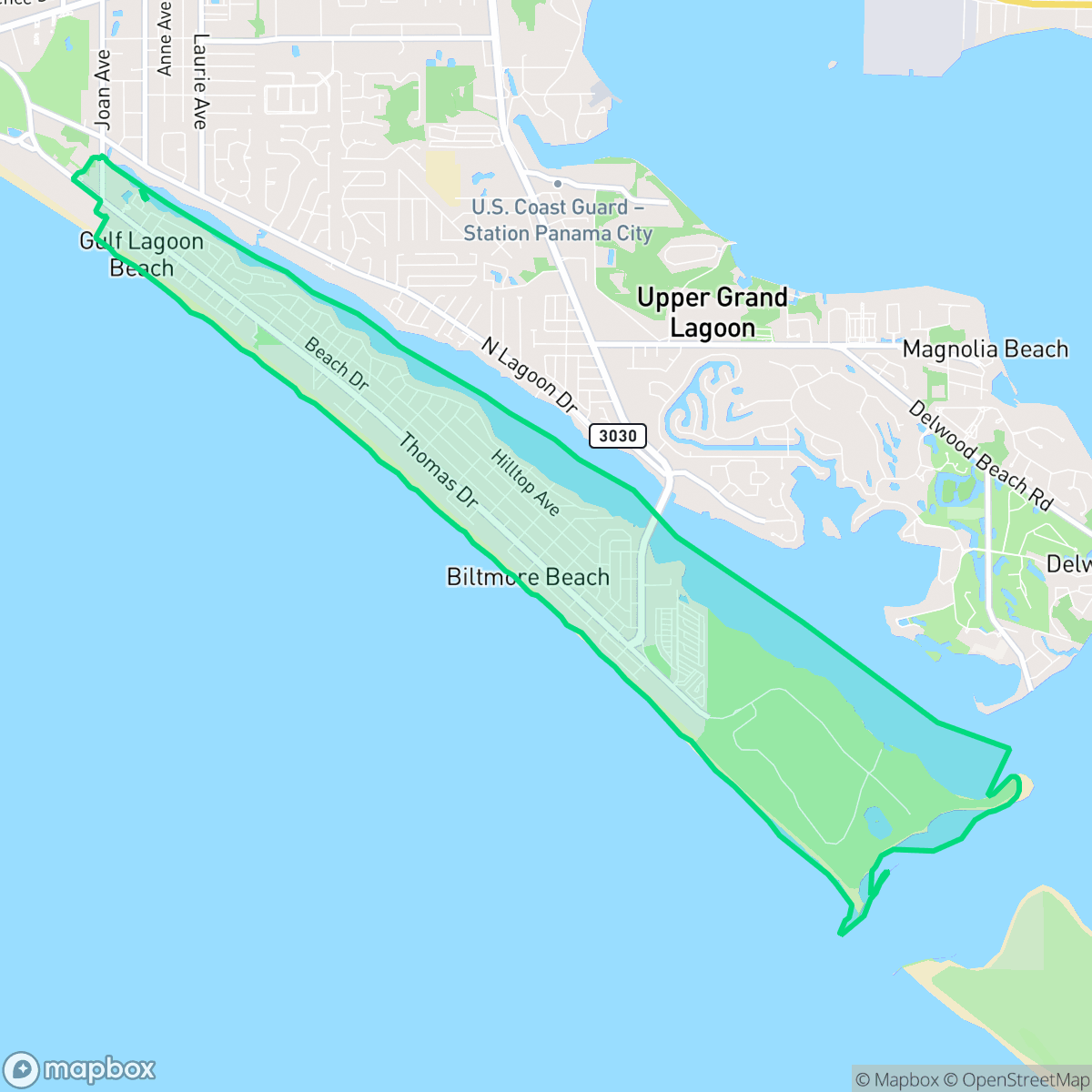
Lower Grand Lagoon is a census-designated place in Bay County, Florida, defined by its deep-water access and nautical character. Situated along the Gulf Coast, the area is historically recognized as a hub for boating and maritime activity, providing direct access to the Gulf of Mexico via St. Andrews Pass. The neighborhood is anchored by the presence of St. Andrews State Park, which serves as a significant landmark and natural boundary for the community. Development in the region has been characterized by a mix of single-family homes and canal-front properties, reflecting a long-standing orientation toward marine recreation and fishing. While the area has evolved into a residential enclave for retirees and seasonal residents, it maintains a distinct identity as a 'boater’s capital' within the broader Panama City Beach metropolitan region.
The neighborhood features a mix of large residential properties and canal-front homes, creating a distinct visual appeal that reflects its maritime heritage. While the area maintains a balanced coastal rhythm, it provides a quiet environment suitable for walking on local streets despite the absence of formal sidewalks. The population is diverse, encompassing a range of age groups from young families to retirees, all contributing to a stable community environment according to iHuus data.
Prospective residents should note that while the area offers a peaceful lifestyle, it experiences moderate traffic noise from nearby thoroughfares. Educational opportunities are managed through the Bay County School District, which presents a mixed landscape where families must navigate between high-performing specialized academies and traditional neighborhood schools. Additionally, flood risk remains difficult to assess due to ongoing FEMA studies, and those moving to the area should prepare for a predominantly conservative political environment.
Neighborhood Scores Across 15 Qualities
Housing density is moderate, offering a mix of spacing and some buffer between neighbors. This level of privacy is consistent with the average found across the city.
Low traffic volumes and calm streets provide a suitable environment for walking, even though the area lacks formal sidewalks. This level of walkability is consistent with the city average according to iHuus data.
Large residential properties and frequent upscale amenities define the visual landscape. This level of aesthetic quality is consistent with the average seen across the city.
Access to public parks and green spaces for pets is consistent with the city average. Residents will find typical availability of walking areas and nearby recreational spots according to iHuus data.
Residential streets and green spaces are distributed in roughly equal measure, matching the typical urban-rural balance found across the city.
Vibrancy levels in this area are consistent with the city average, offering a mix of quiet residential streets and energetic coastal hubs. Residents can experience both low-key suburban pockets near the coastline and lively dining districts centered around local parks and transit points.
A steady hum of local traffic originates from nearby busy streets, which aligns with the city average for acoustic levels.
Industrial activity is negligible in this area, as the landscape consists primarily of residential spaces and light commercial uses like cafes or hotels. According to iHuus data, the level of industrial proximity is consistent with the city average.
Health insurance enrollment in this area is consistent with the city average. According to iHuus data, a moderate portion of the resident population maintains coverage.
Voting patterns and census indicators reflect a predominantly conservative political landscape. This ideological leaning is consistent with the broader city average, according to iHuus data.
Residents will find a balanced mix of young adults, families, and older individuals. According to iHuus data, the age distribution in this area aligns closely with the city average.
Flood risk levels in this area are currently difficult to assess because FEMA has not finished a detailed study for the location. This level of uncertainty is consistent with the city average, according to iHuus data.
Address-Level Insights for Lower Grand Lagoon


iHuus Neighborhood Intelligence Insights
Get address-level neighborhood insights for Lower Grand Lagoon
- Street-level scores — see how individual blocks compare, not just neighborhood averages
- Micro-zone boundaries — identify quiet pockets, flood boundaries, and walkable clusters before you visit
- 15 dimensions in full — walkability, noise, air quality, school quality, insurance coverage, population age profile, urban/rural index, and more
- Boundary risk alerts — know if your address sits near a block boundary where scores drop, the kind of detail no listing will ever mention
- School insights — individual school ratings and insights, not just district-level data
- Compare before you commit — side-by-side data across neighborhoods, down to block precision
No credit card required
Lower Grand Lagoon Rankings
School Districts Serving Lower Grand Lagoon
School Insights for Lower Grand Lagoon
Below average outcomes; significant attendance and academic challenges.
School Insights
See what's really behind every school rating near Lower Grand Lagoon
- Individual school ratings — each school's own score with outcome context, not just a district average
- Enrollment & class size data — student-to-teacher ratio and how it compares to the state average
- Full demographics breakdown — ethnicity and gender composition for every school in the enrollment zone
- Every school in the district — all schools within the enrollment boundary ranked by rating, not just the closest one
- Grade levels & benchmarks — elementary through high school, with below/above state-average flags
No credit card required