University Heights, West Menlo Park
Updated · 2,723 residents
University Heights is a quiet, residential enclave characterized by custom estates and a semi-rural atmosphere. While the area is highly walkable with safe pedestrian paths, residents primarily rely on vehicles for daily errands due to the limited number of local commercial destinations.
Key Highlights
About University Heights
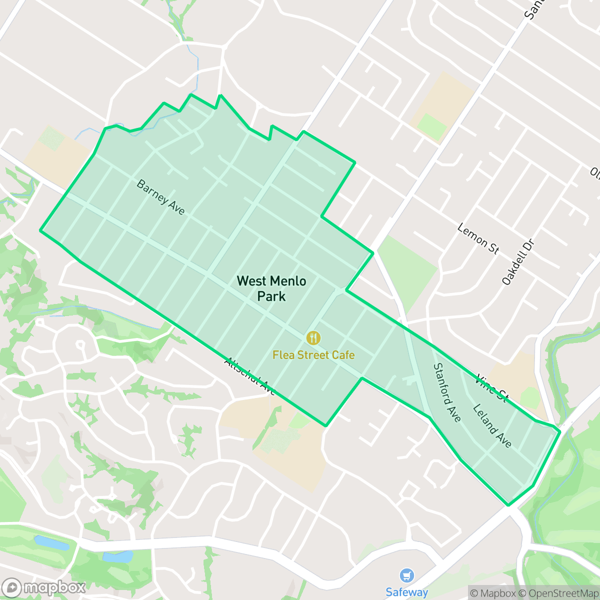
University Heights, an unincorporated community in San Mateo County often referred to as West Menlo Park, was established in the early 1890s as a speculative real estate development. Spearheaded by Eugene Avy and realtor Nathan Carnall, the subdivision was carved from John Murray’s 70-acre Stanford Dairy farm. The developers aggressively marketed the tract as being 'near the Leland Stanford University' to attract buyers ahead of the university's 1891 opening. Unlike the incorporated city of Menlo Park, this neighborhood remains an unincorporated area, a status that has historically influenced its distinct development patterns and building regulations. Today, the neighborhood is defined by its residential character along the Alameda de las Pulgas corridor, maintaining a separate identity from the surrounding city while serving as a long-standing residential enclave in the region.
The neighborhood features a distinct aesthetic defined by expansive, custom-built estates and lush, private landscaping. The environment offers a peaceful retreat with a semi-rural feel, marked by open spaces and woodlands that provide a sense of separation from the denser parts of the region. Residents benefit from a highly walkable street layout, featuring well-maintained sidewalks and safe crossings that make the area conducive to outdoor activity and pet walking according to iHuus data.
Living here involves a trade-off between the serene, residential atmosphere and a lack of immediate commercial amenities, necessitating travel for most daily needs. While the area is free from industrial activity and maintains excellent health insurance coverage, it is subject to a steady hum of traffic noise from nearby thoroughfares. The community is served by high-performing local school districts, making it an attractive option for families seeking a stable, education-focused environment within a quiet, estate-like setting.
Neighborhood Scores Across 15 Qualities
Residential spacing provides a moderate level of separation between properties. This balance of density and buffer is consistent with the average seen throughout West Menlo Park.
Sidewalks are available on one side of the street and safe crossings are present; this level of walkability is slightly above the West Menlo Park average according to iHuus data.
Large, custom estates and lush privacy buffers define the local landscape. This level of visual quality is consistent with the broader Menlo Park area.
Connected green spaces and wide, traffic-safe paths make this area slightly more dog friendly than the rest of the city. According to iHuus data, the layout of the neighborhood provides reliable access to open areas for walking pets.
Frequent open land and scattered homes among woodlands define this area, which is slightly less dense than the typical West Menlo Park landscape according to iHuus data.
Serene residential streets and green spaces characterize this area, though a lack of local destinations makes it slightly more car-oriented than the rest of the city. While a few small cafes and eateries are accessible, most daily needs require driving.
Local traffic from a nearby busy street creates a consistent level of noise. This acoustic environment is typical for the city average.
Air quality in this area fluctuates between acceptable and unhealthy levels on certain days. This pattern is consistent with the average seen across the rest of the city.
Industrial activity is nonexistent in this area, as the neighborhood contains no warehouses, manufacturing facilities, or hazard sites. This lack of industrial presence is consistent with the rest of Menlo Park.
Health insurance coverage is nearly universal among residents, matching the high coverage rates seen across the rest of the city.
Voting patterns and census indicators show a predominantly liberal political leaning, which is consistent with the rest of Menlo Park.
Residents live among a diverse mix of young adults, families, and older individuals. This demographic distribution is consistent with the broader West Menlo Park area, according to iHuus data.
Flood risk levels remain uncertain due to a lack of detailed FEMA studies for this specific area. This level of risk is slightly higher than the average found across the rest of the city, according to iHuus data.
Address-Level Insights for University Heights


iHuus Neighborhood Intelligence Insights
Get address-level neighborhood insights for University Heights
- Street-level scores — see how individual blocks compare, not just neighborhood averages
- Micro-zone boundaries — identify quiet pockets, flood boundaries, and walkable clusters before you visit
- 15 dimensions in full — walkability, noise, air quality, school quality, insurance coverage, population age profile, urban/rural index, and more
- Boundary risk alerts — know if your address sits near a block boundary where scores drop, the kind of detail no listing will ever mention
- School insights — individual school ratings and insights, not just district-level data
- Compare before you commit — side-by-side data across neighborhoods, down to block precision
No credit card required
University Heights Rankings
School Districts Serving University Heights
School Insights for University Heights
Below average outcomes; significant attendance and academic challenges.
School Insights
See what's really behind every school rating near University Heights
- Individual school ratings — each school's own score with outcome context, not just a district average
- Enrollment & class size data — student-to-teacher ratio and how it compares to the state average
- Full demographics breakdown — ethnicity and gender composition for every school in the enrollment zone
- Every school in the district — all schools within the enrollment boundary ranked by rating, not just the closest one
- Grade levels & benchmarks — elementary through high school, with below/above state-average flags
No credit card required