Harbor Gateway, Gardena
Updated · 36,766 residents
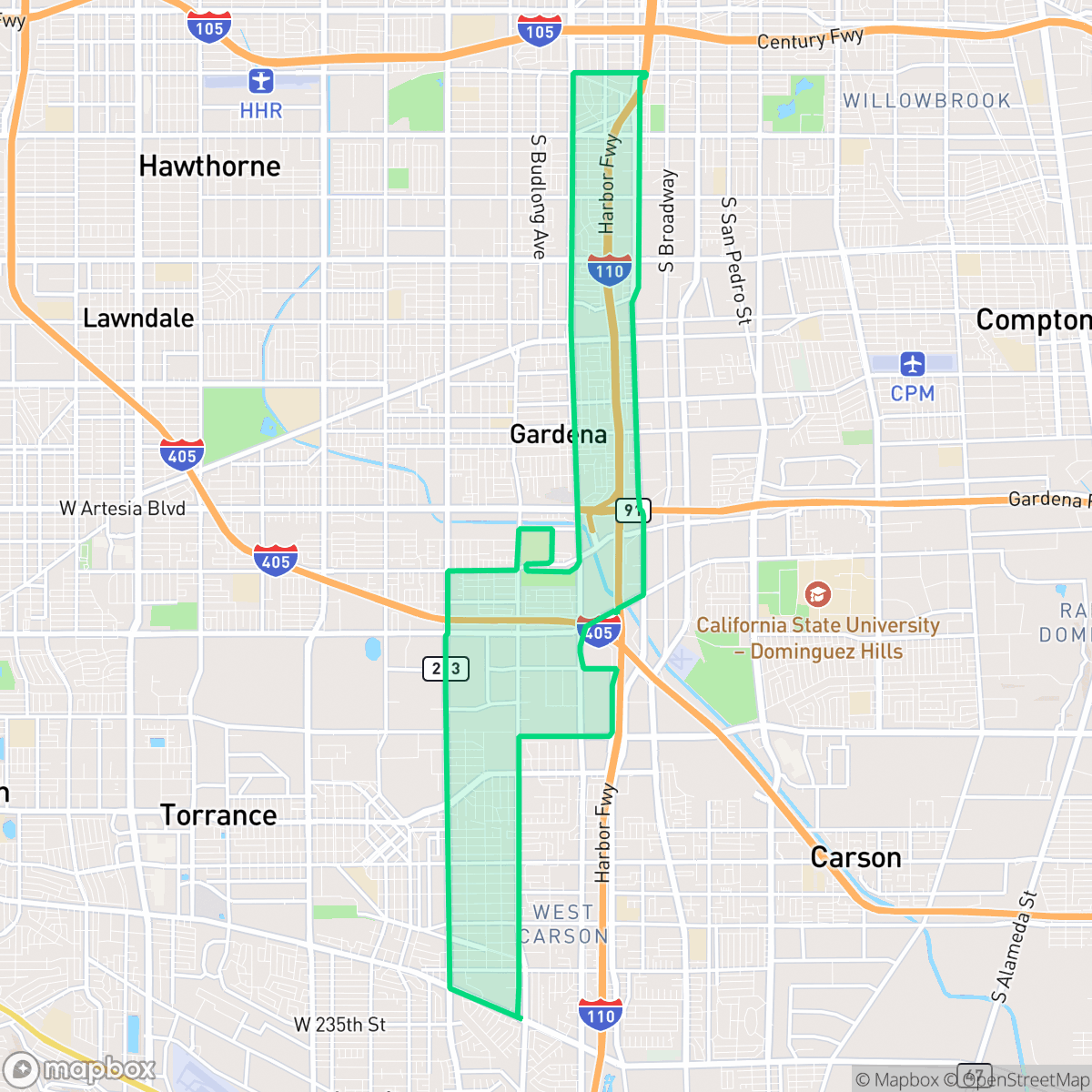
Harbor Gateway is a diverse, high-density residential and industrial corridor defined by its unique geography as a narrow link between Los Angeles and the southern ports. While the area offers a consistent sidewalk grid and access to reputable schools, residents face significant noise from road traffic and proximity to industrial logistics hubs.
Key Highlights
About Harbor Gateway
Originally part of Rancho San Pedro, the Harbor Gateway neighborhood of Los Angeles was annexed in 1906 during a "shoestring annexation". This narrow, two-mile-wide corridor—historically known as the "shoestring strip"—was acquired to connect Los Angeles to the ports of San Pedro and Wilmington. It was officially renamed Harbor Gateway in 1985 to foster community identity. Following World War II, many Japanese Americans returning from relocation camps resettled in the northern section, establishing thriving nurseries and small farms. This cultural heritage is preserved in the Chacksfield Tract Residential Historic District, which features Traditional Ranch House architecture complemented by Japanese-style gardens showcasing manicured black pines and stone lanterns. Today, the neighborhood remains a highly diverse residential and industrial hub.
The area functions as a dense, low-rise urban environment where single-family homes and multi-unit complexes sit alongside large-scale warehouses and logistics facilities. This layout creates a distinct, car-oriented atmosphere where industrial zones and residential blocks share space. The community maintains a steady, quiet pace, with local dining and essential services scattered throughout the grid.
Prospective residents should consider the trade-offs of living in a high-density industrial corridor, specifically regarding acoustic comfort and limited private outdoor space. While the neighborhood provides access to high-performing schools within the Torrance Unified School District, the prevalence of nearby industrial sites and heavy freight traffic necessitates careful consideration of specific street locations. It is best suited for those prioritizing proximity to major transit routes and educational opportunities over expansive green space or quiet, secluded living.
Neighborhood Scores Across 15 Qualities
Residential structures are often closely packed with minimal side-yard setbacks. According to iHuus data, this high-density layout provides less separation between neighbors than is typical for the rest of Gardena.
Sidewalks and marked crosswalks are widely available on most residential and commercial streets, though high-traffic arterials and a major freeway corridor can segment the walking routes. This level of pedestrian infrastructure is slightly lower than the Gardena city average.
Uniform tract housing and apartment complexes define the landscape, featuring repetitive rooflines and small yards. This visual character is consistent with the broader Gardena area.
Walking opportunities for pets are primarily restricted to private backyards and narrow sidewalks due to a lack of widespread public parks. This availability of accessible green space is slightly below the Gardena average, according to iHuus data.
A prominent presence of large-scale warehouses and logistics hubs characterizes this area, offering a more developed landscape than the Gardena average. The environment consists of a dense mix of single-family residential blocks and significant industrial infrastructure.
A primarily industrial and suburban landscape defines this area, where much of the activity is centered around warehouses and highway corridors. Most daily errands and dining options require a vehicle, as the level of local vibrancy is lower than the Gardena average.
Frequent noise from nearby freeway traffic and railroad proximity creates an environment that is slightly more disruptive than the Gardena average, according to iHuus data.
Air quality remains mostly clean with only rare instances of elevated readings. According to iHuus data, this level of air quality is better than the average for Gardena.
Significant warehouse activity and heavy freight traffic are present alongside residential areas, making the industrial density higher than the Gardena average. Residents should be aware of nearby logistics hubs and the proximity of an EPA Superfund site that may impact soil and groundwater.
Health insurance access is roughly in line with the Gardena average. According to iHuus data, a significant portion of the local population remains uninsured.
Voting patterns and census indicators in this area reflect a strong liberal leaning, which is very similar to the broader Gardena area according to iHuus data.
A balanced demographic of young professionals, families, and seniors resides here, mirroring the broader distribution found across Gardena. According to iHuus data, this variety provides a stable residential landscape with no significant concentration of a single age group.
Properties in this area are situated within a designated floodplain, which represents a higher risk level than much of Gardena. According to iHuus data, residents should anticipate a greater need for flood insurance due to this vulnerability.
Address-Level Insights for Harbor Gateway


iHuus Neighborhood Intelligence Insights
Get address-level neighborhood insights for Harbor Gateway
- Street-level scores — see how individual blocks compare, not just neighborhood averages
- Micro-zone boundaries — identify quiet pockets, flood boundaries, and walkable clusters before you visit
- 15 dimensions in full — walkability, noise, air quality, school quality, insurance coverage, population age profile, urban/rural index, and more
- Boundary risk alerts — know if your address sits near a block boundary where scores drop, the kind of detail no listing will ever mention
- School insights — individual school ratings and insights, not just district-level data
- Compare before you commit — side-by-side data across neighborhoods, down to block precision
No credit card required
Harbor Gateway Rankings
School Districts Serving Harbor Gateway
School Insights for Harbor Gateway
Below average outcomes; significant attendance and academic challenges.
School Insights
See what's really behind every school rating near Harbor Gateway
- Individual school ratings — each school's own score with outcome context, not just a district average
- Enrollment & class size data — student-to-teacher ratio and how it compares to the state average
- Full demographics breakdown — ethnicity and gender composition for every school in the enrollment zone
- Every school in the district — all schools within the enrollment boundary ranked by rating, not just the closest one
- Grade levels & benchmarks — elementary through high school, with below/above state-average flags
No credit card required